Oops…..

Friday – 20 November

Although the distance for today’s travels was scheduled to be short, the planning and considerations for the day were not.

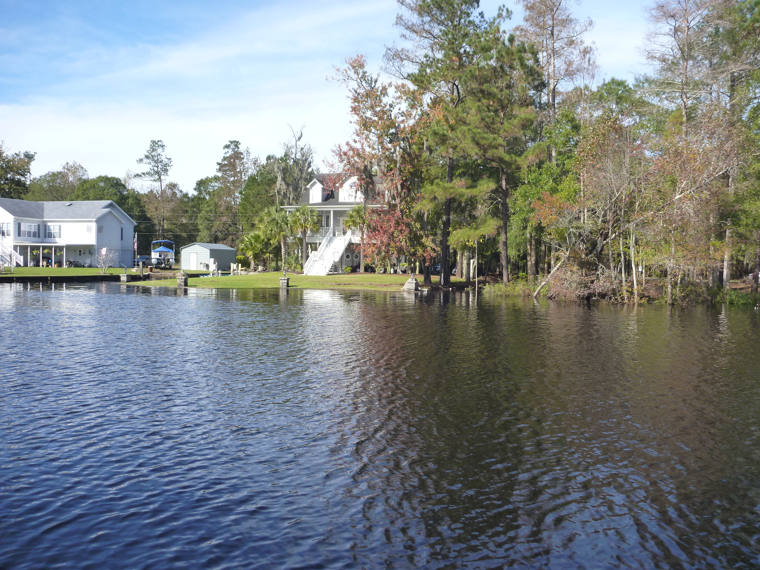
To transit between Isle of Palms to Charleston we learned we would be passing through a traditionally very shallow section of the Waterway.  In reading the reports of others, many have said after transiting this section once, they choose to jump out to the ocean for all future transits.  It was recommended not to attempt the travel until near or at high tide to allow for the deepest water possible.

The second consideration for planning the day was scheduling it with the timing of a swing bridge.  The Ben Sawyer Bridge doesn’t open between 0700 and 0900.  After that it opens on request during the week.

The third consideration for planning the day was planning for the strong currents Charleston is known for.  Cruising friends who are from this area made a specific point of warning us of this the day before.  So we hoped to be able to arrive in Charleston during slack water which Bob’s research indicated would be around 1430.

Research revealed that high tide could be expected around 1230, we expected the day’s journey to take about 2 hours and so everything pointed toward a 12 – 1230 departure to have all concerns align as best they could.

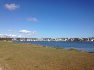
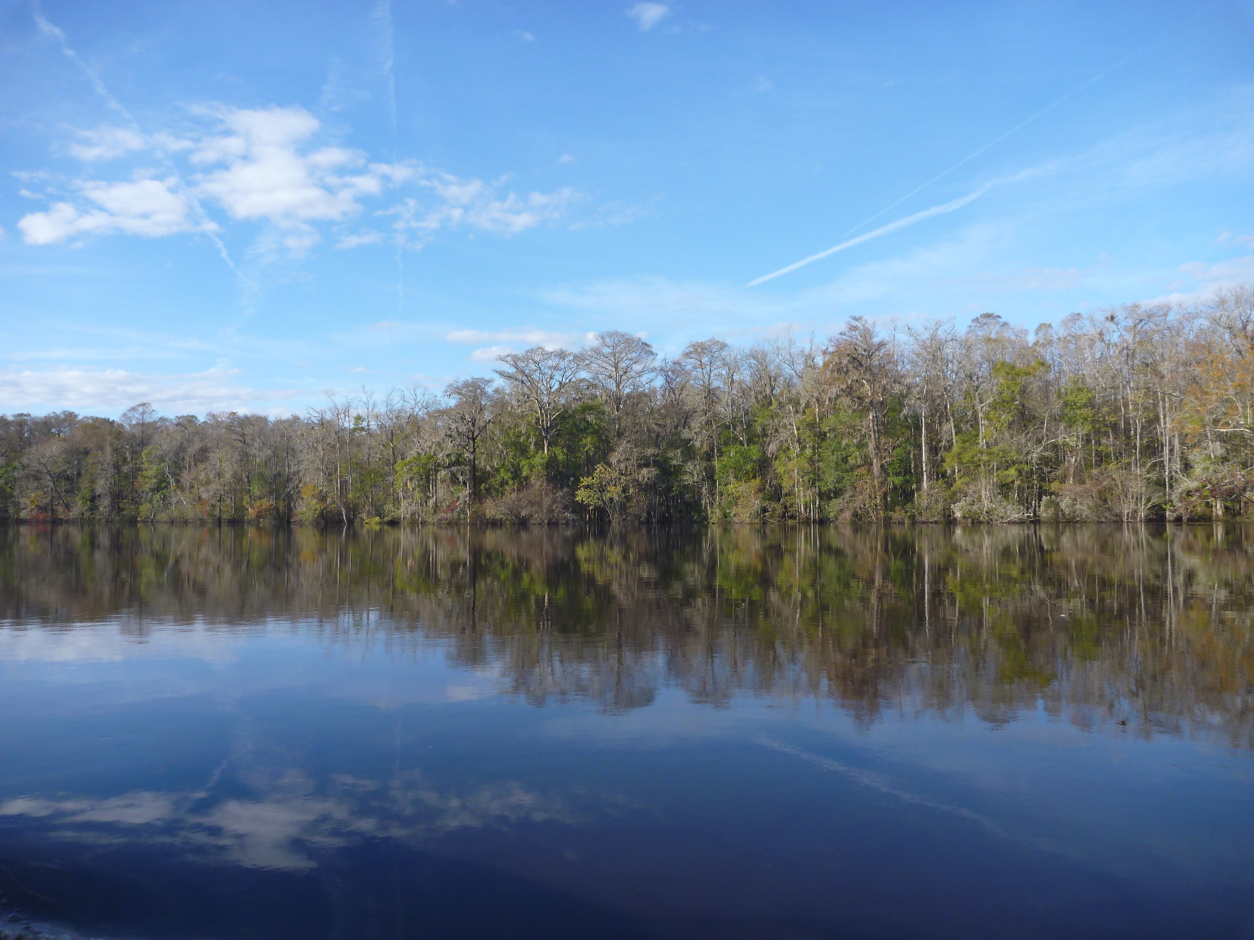
For the first time we were in no hurry to depart the marina at the crack of dawn and so we enjoyed a leisurely morning which included a long walk on land on this most beautiful, albeit windy/brisk, morning.

Typically we plan for a departure at whatever time, and find ourselves ready to go 15 – 30 minutes before that, and usually we just go.  Today was no different in that we were ready before the set time, but today we made every effort to wait.

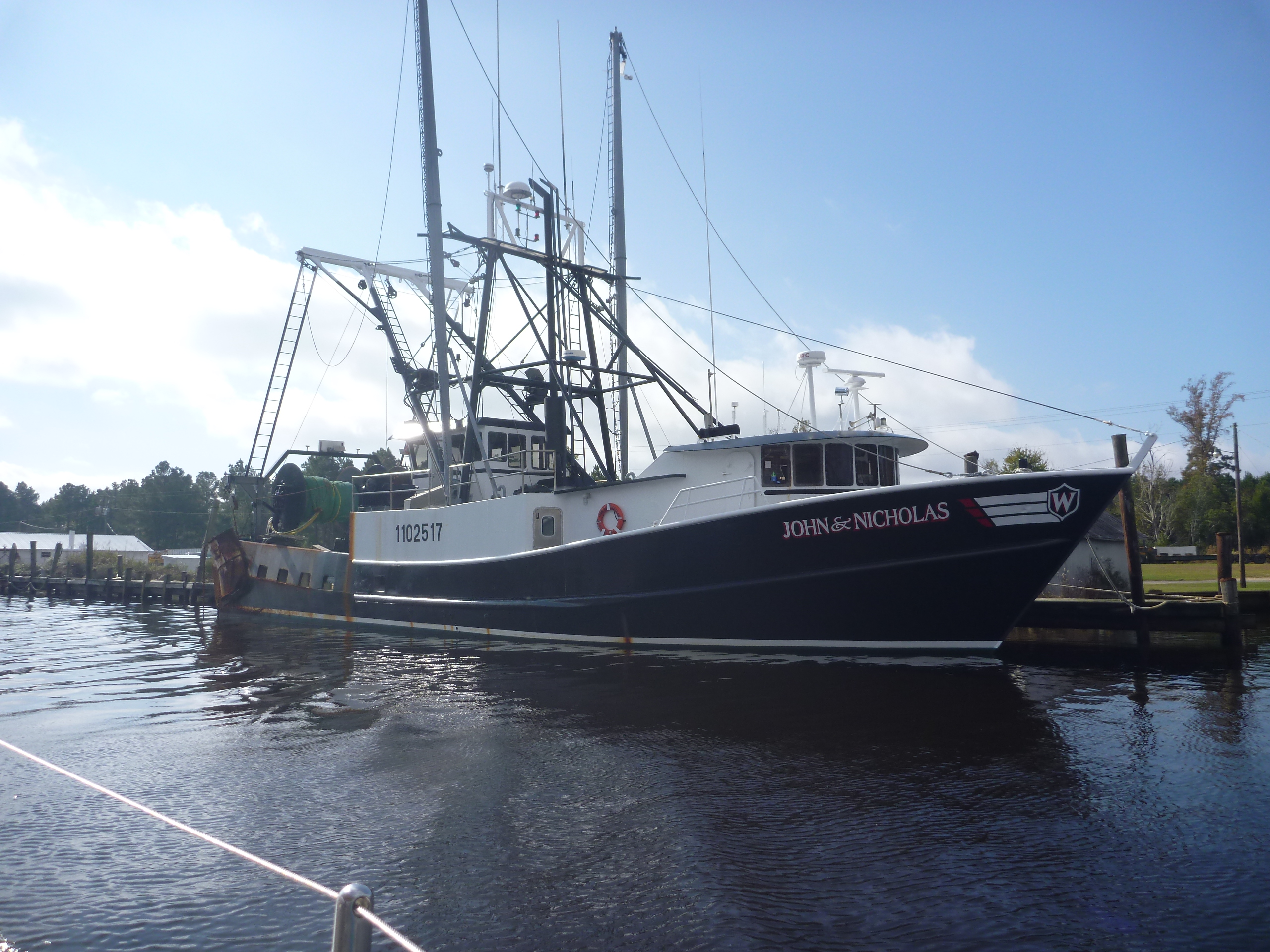
Our friends from Rock Hall, left 2 hours before us.  We radioed them to see what depths they had encountered in the shallow section.  They reported back 6.5 feet.  We felt pretty comfortable that waiting the extra time would give us even more depth and less stress.

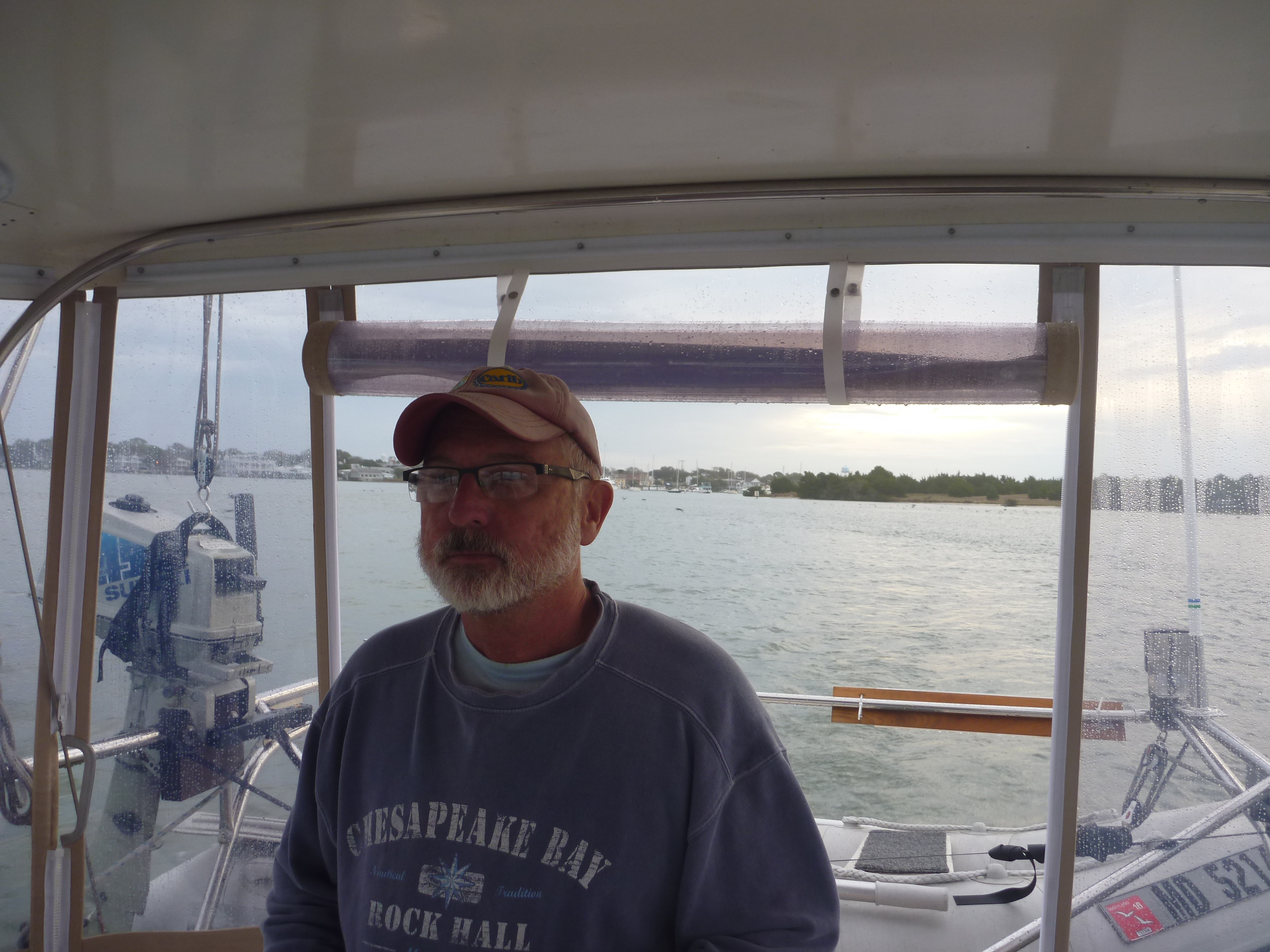
As we prepared to back out of our slip with the assistance of a neighbor from the boat next door,  a confluence of situations arose that caused a number of issues. 1)  The wind picked up at exactly the wrong time, making it difficult to control the boat in the tight quarters at the slow speed of maneuvering in reverse making a turn 2) A tour group of inexperienced kayakers appeared astern of us preparing to return to the boat ramp, making for a moving obstacle course 3) Two powerboats made the turn from the Waterway into the channel we were maneuvering in 4) The current was strong  and 5) Have we mentioned the boat backs like a pig, backs to port (rather than straight) and takes a different level of skill?

As Christina was tending to lines and fending the boat off the dock Bob was at the helm trying his best to work around the obstacles.  We got a little closer to the next dock than would have been preferred and the dinghy appeared to hit something as he was pulling away.

We went through the kayakers and the guide hollered at us as we were turning into the Waterway that we were dragging something behind us.  We looked and discovered it was part of the dock!

At the end of the dock there is (or should we say was) a wheel bumper that spins as boats enter/exit the slip so as to prevent damage to both dock and boat.  Our dinghy painter (the rope used to tow the dinghy) hangs a bit below the dinghy when its on the davits and somehow had looped onto the wheel and got caught.  When Bob pulled away, thinking he was fighting current, the boat actually had pulled this wheel off the dock along with a large piece of wood it was attached to and it was now trailing us, still attached to the dinghy painter.  Ooops!

So here we are entering the busy Waterway with a large powerboat bearing down on us as we needed to find a way to free ourselves from this floating debris.  Christina didn’t have the strength or reach to pull the line in and free the wheel and wood from the line, so she took the helm while Bob dislodged the offending device.  We felt really badly about introducing a new water hazard to other boaters in the Waterway but we could figure no other way.

Bob has talked about filming some of the bizarre antics we have seen and posting a series of YouTube videos entitled “Idiots of the ICW”.  But after realizing he had been towing half the dock away from the Isle of Palms Marina he admits that this may have to be the first installment.

But this is also a testament to the strength of the Gozzard — the fact that it was the the dock that ripped away and not the dinghy or davits which are still fully intact and not damaged.  A dock is no match for a Gozzard.  Needless to say, the dinghy painter is now secured tighter and no longer dangling below the dinghy.

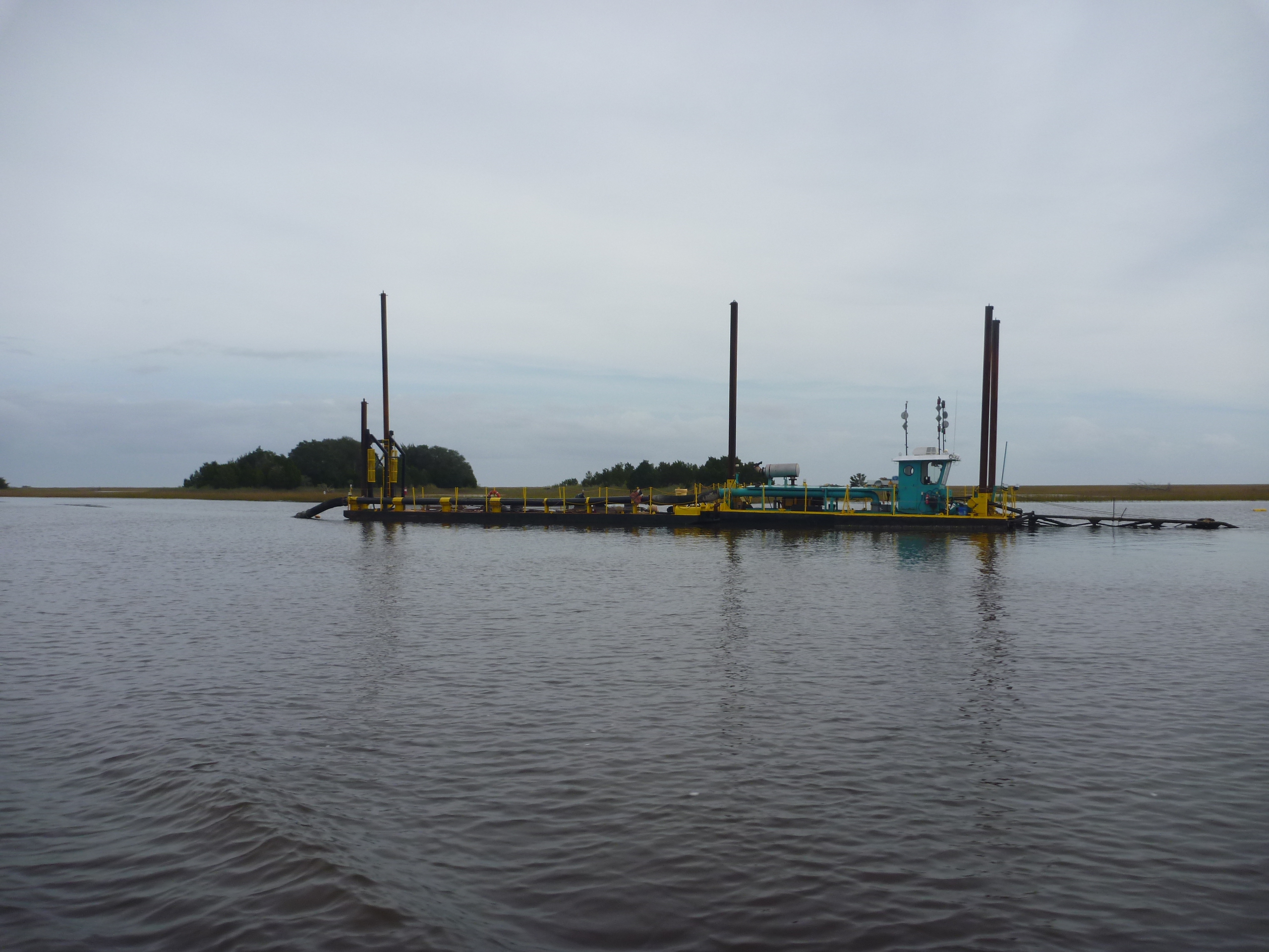
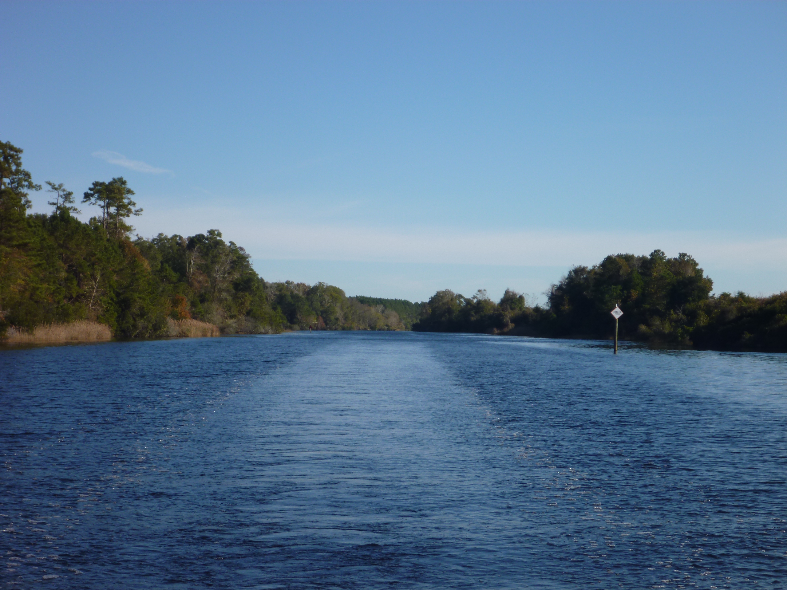
As we were recovering from this little escapade, we passed by the channel marker we knew indicated we were entering the mile of shallow section.  That big powerboat that had been bearing down on us earlier, was now ahead of us and we watched him as he navigated through the section.  Just as Christina was trying to raise him on the radio to learn what depths he had been experiencing, we saw him stop and turn his boat around.  He reported seeing 5.5 feet and he was going to turn around and try to find deeper water.  A fisherman on the radio told the powerboat to go more toward starboard (red side) of the channel, further than you would think was safe, to find the deeper water.  He got through with no further incident. We tried to follow suit.

The depth kept getting shallower and shallower and ultimately we hit 4.5 feet of water — meaning we had hit ground.  But the momentum of the boat and with the strong current we pushed through the mud  and didn’t get stopped.  The water got deeper very soon after that with readings of 16 – 20 feet.  But then would shallow up again, and we saw depths of 7.5 a couple more times.  Even though we know we can call the tow boat to get us off if ever we need to, it is still stressful when we get so close to grounding.

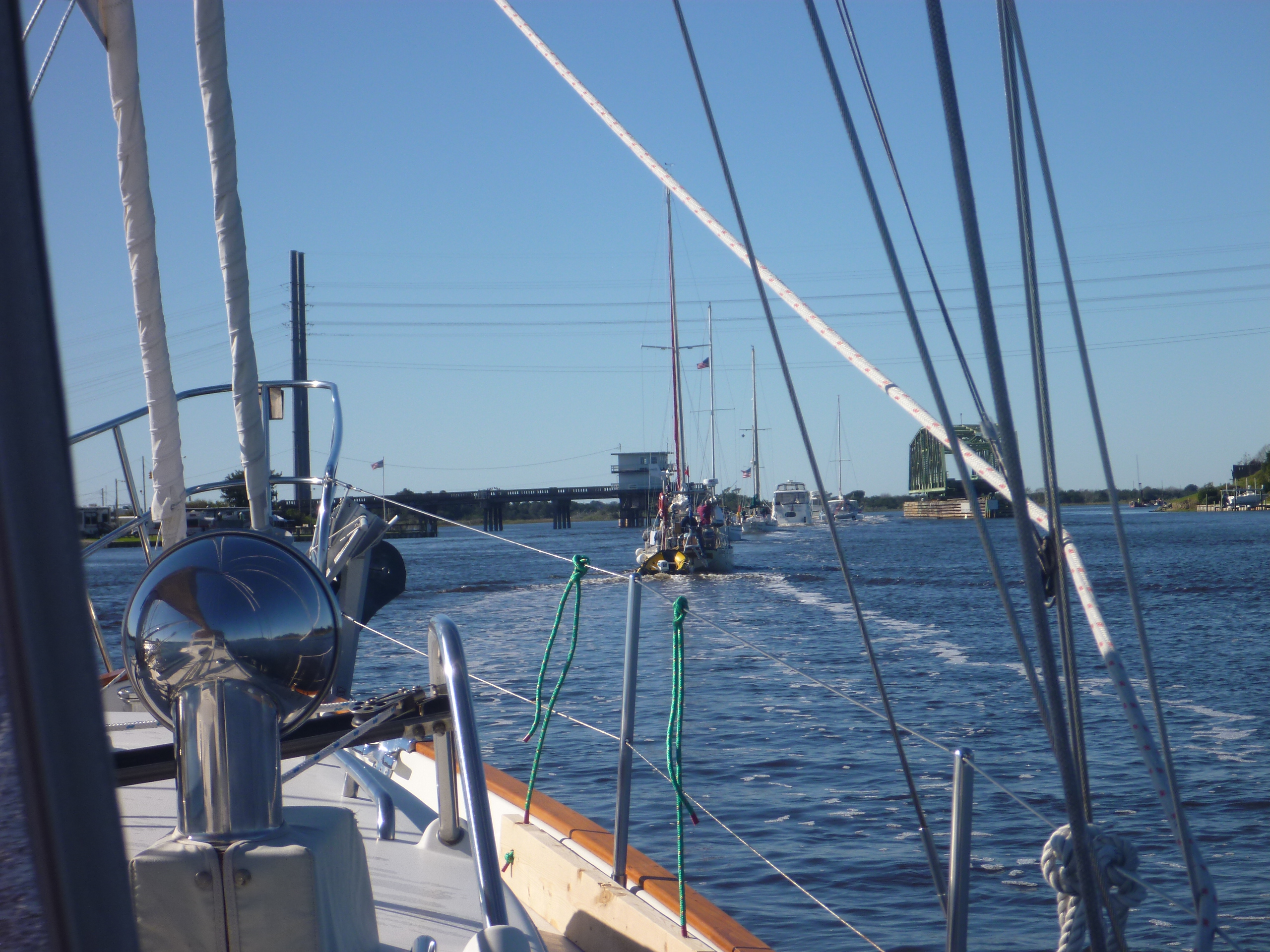
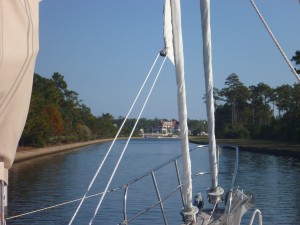
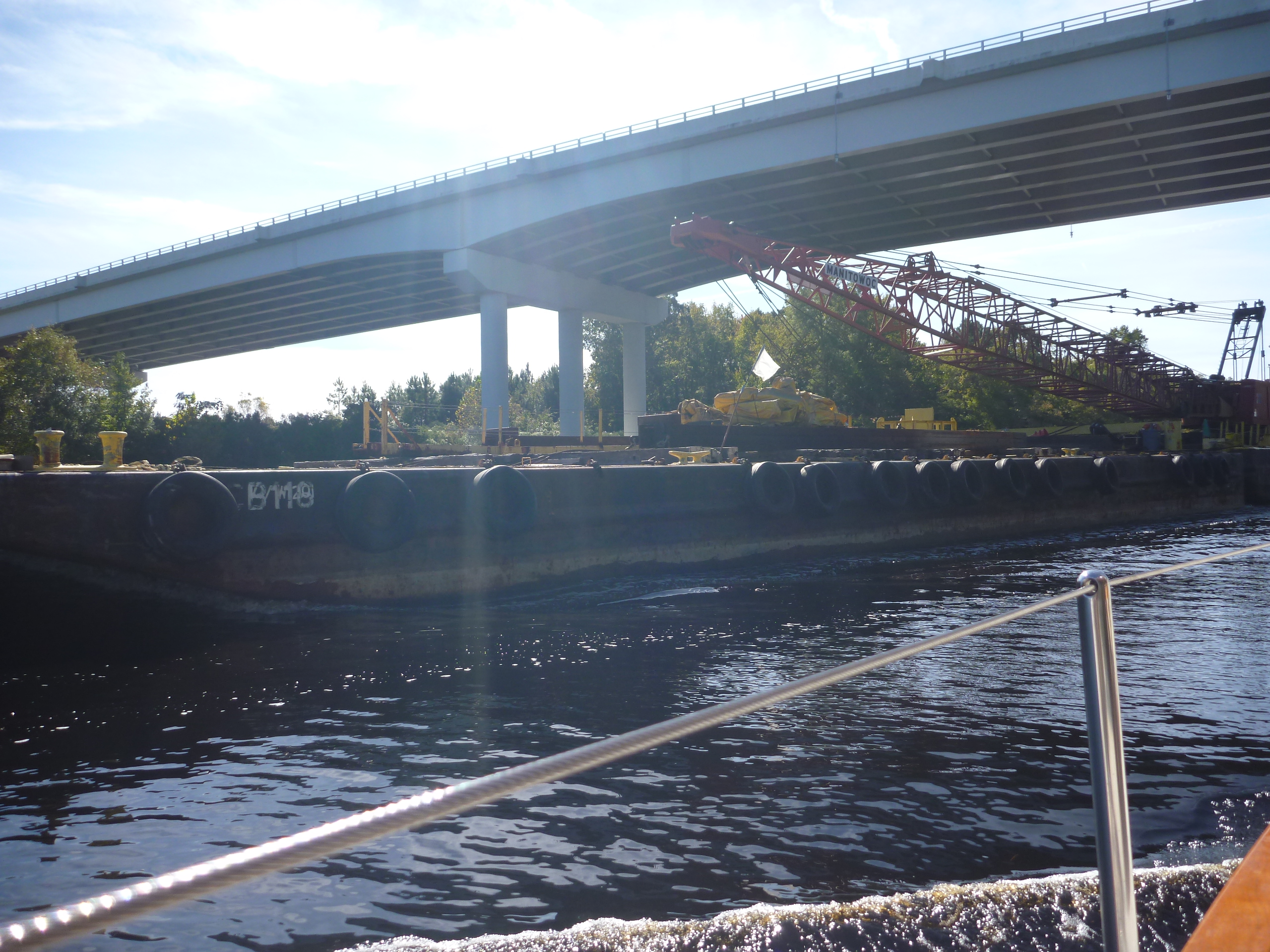
Right after the shallow section is the swing bridge we must request an opening for.  Christina hailed the bridge tender on the radio and let them know where we were and that we were requesting an opening.  We saw there were now two more sailboats behind us, so we figured we would have to wait a bit before the bridge was opened, so all 3 boats could go through on the same opening.  We slowed down as best we could with the current pushing us, and waited.

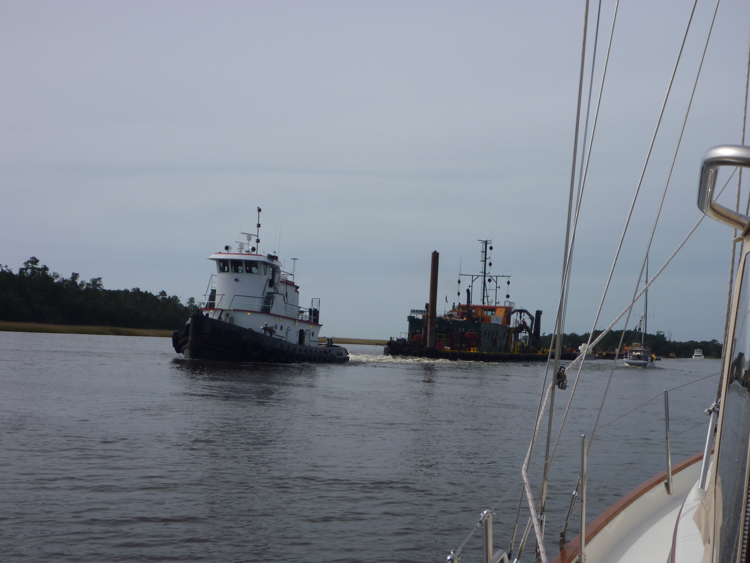
Then we heard a tug with barge radio the bridge that they were approaching from the other side (Northbound).  Not being sure who had the right of way at this point (usually the boat with the current has right of way but big boats with less maneuverability also have right of way at bridges and really — who really knew which way the current was going) – we radioed the bridge to query who would have right of way to pass through the bridge first, and asked for direction.  She confirmed the tug would have right of way and asked us to hold back a bit.  No problem.

As the other two sailboats were approaching the bridge behind us, another large powerboat passed us all and went full speed toward the bridge.  About this time the tug with barge warned the bridge tender he was approaching faster than expected and wasn’t sure if he would be able to easily stop if the bridge didn’t open soon.  The bridge began to open and we couldn’t believe our eyes as we watched the powerboat on our side of the bridge aim straight toward the oncoming tug with barge.  We guess he thought he should have right of way.  The bridge tender and the tug both tried to hail the boat on the radio and emphatically told him he was in an unsafe position but apparently the boat either didn’t have his radio on or tuned to the right channel because there was no contact.  The tug blew his horn 5 blasts to warn the power boat as he was going through the bridge and it really looked like there would be an imminent collision.

At the last minute the powerboat seemed to recognize the situation he was in, and moved a bit to starboard and squeezed though the bridge alongside the tug with barge.  We would have loved to have heard whatever exchange of words there was between the tug and powerboat.

Another installment for “Idiots of the ICW”.

Charleston Bridge 2
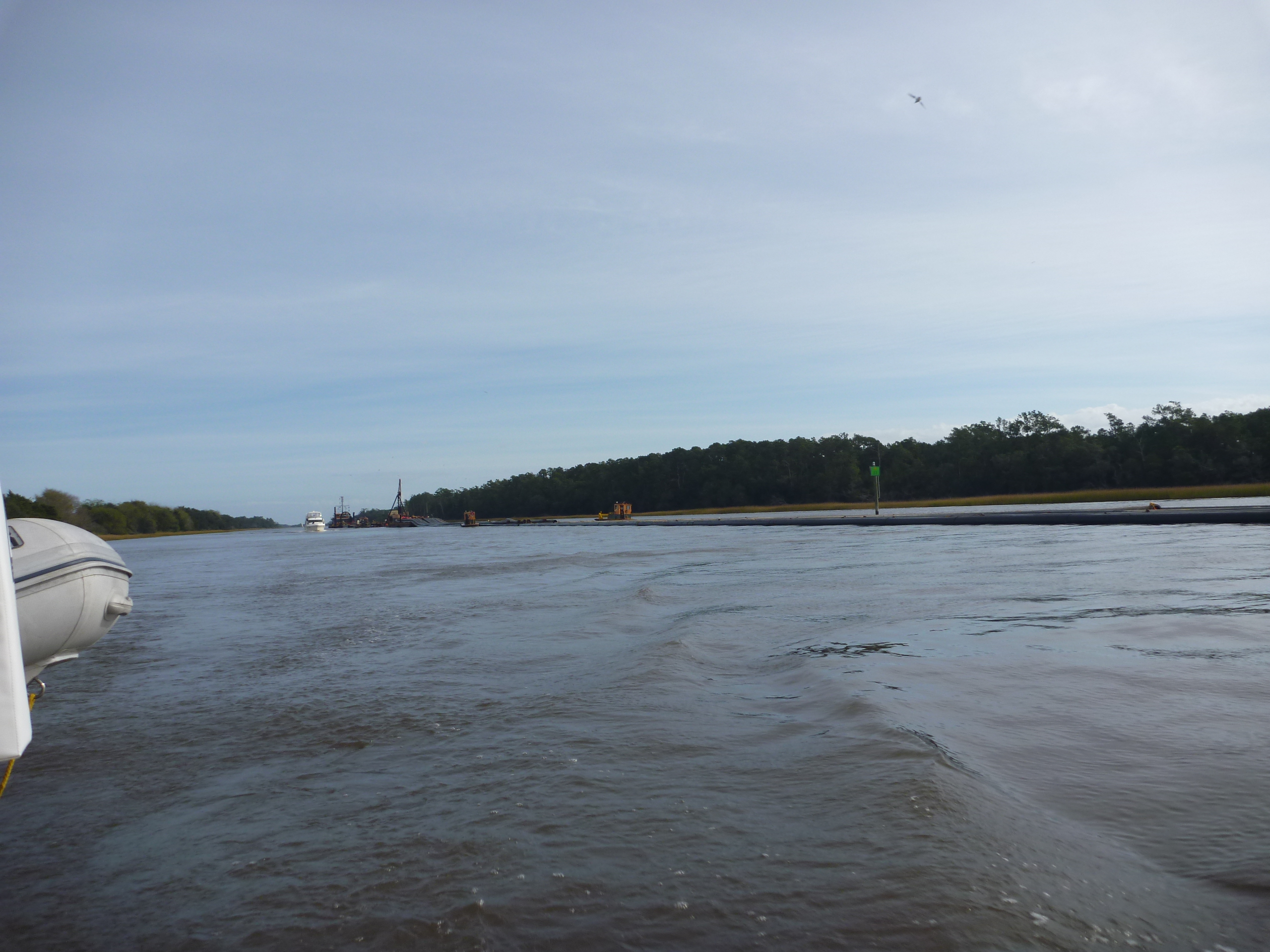
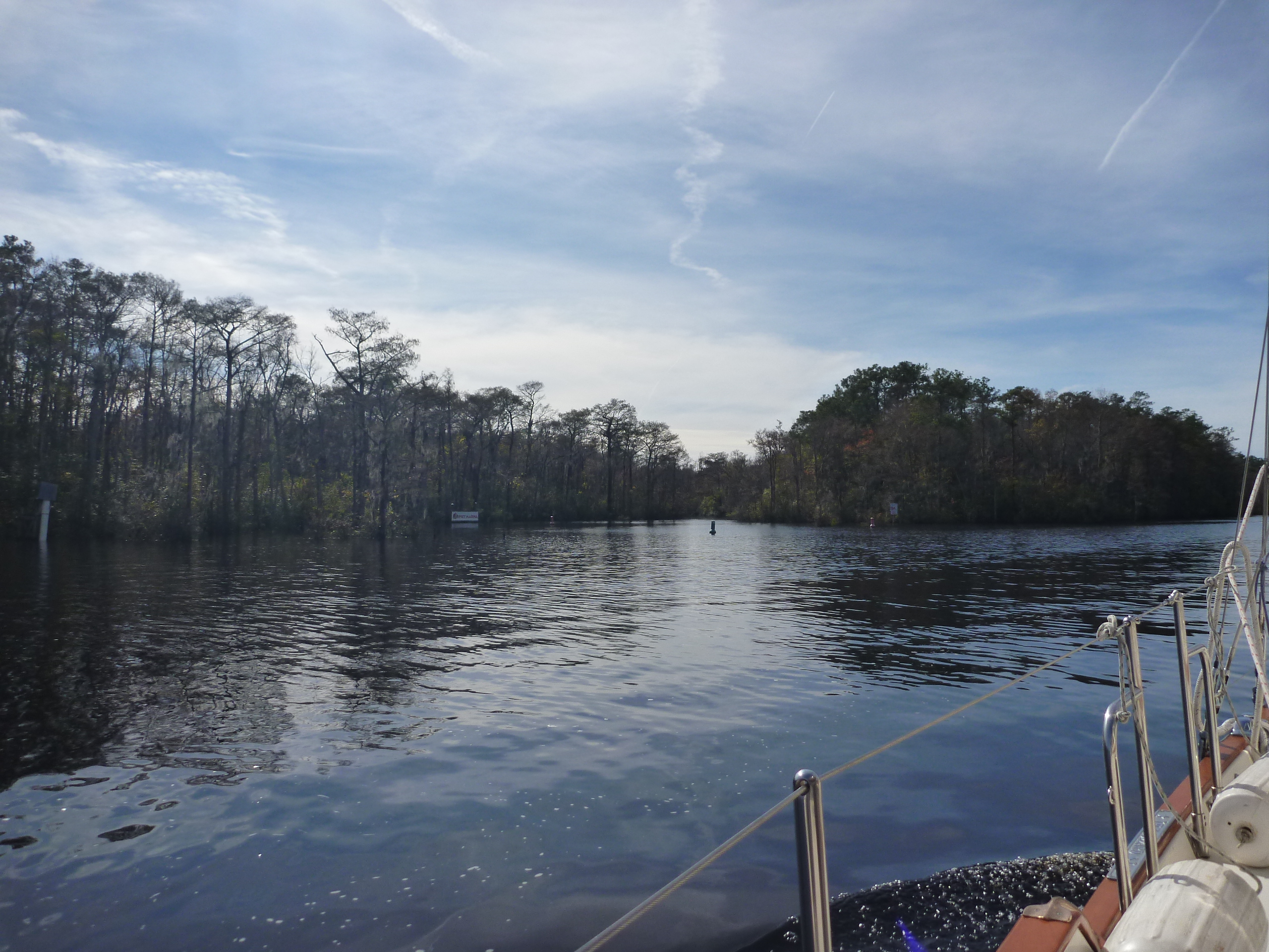
Shortly after the bridge we needed to navigate into the Charleston harbor.  The markers were not that apparent and we let the other two sailboats pass us to lead the way.

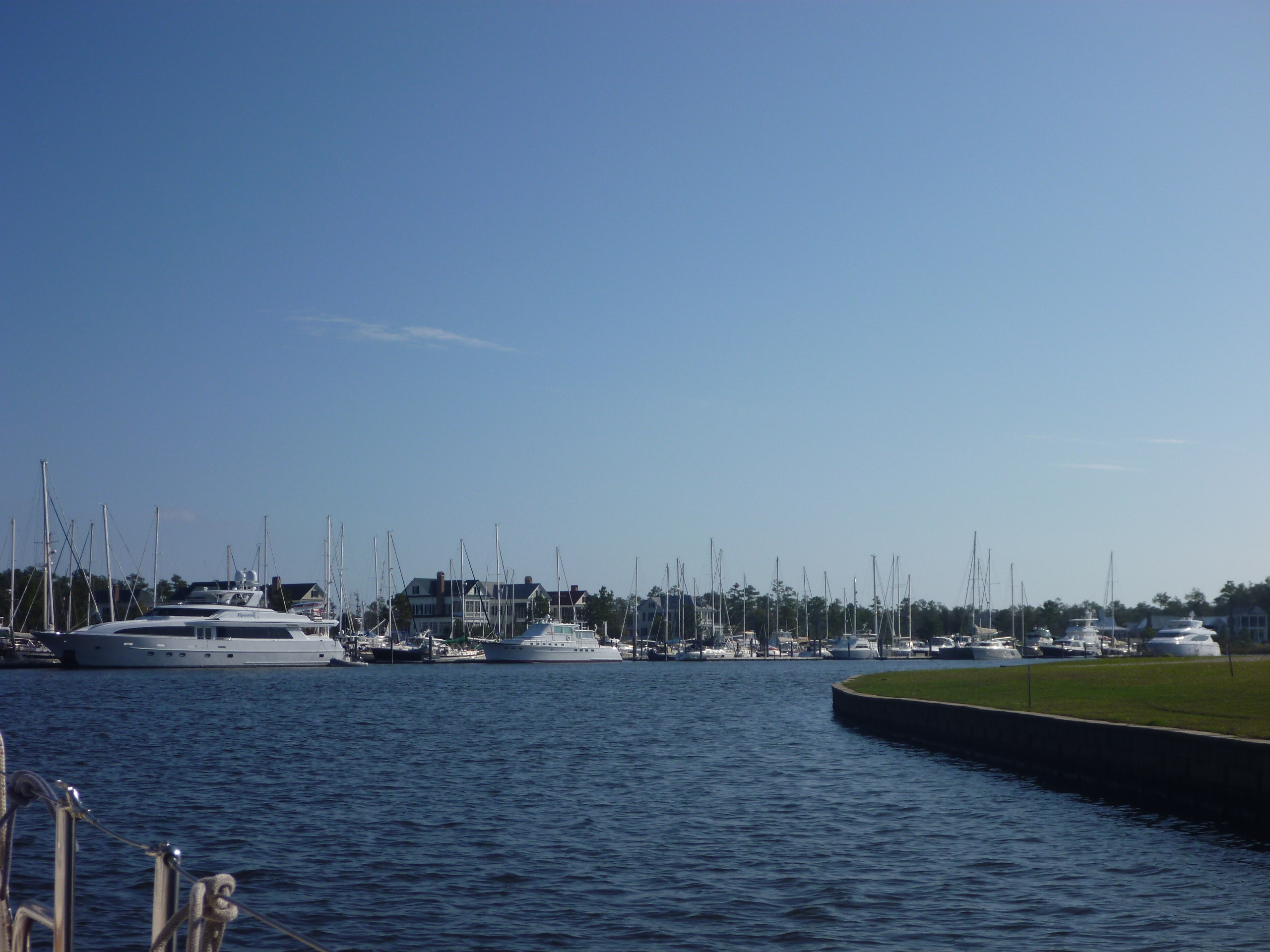
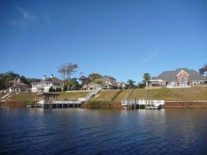
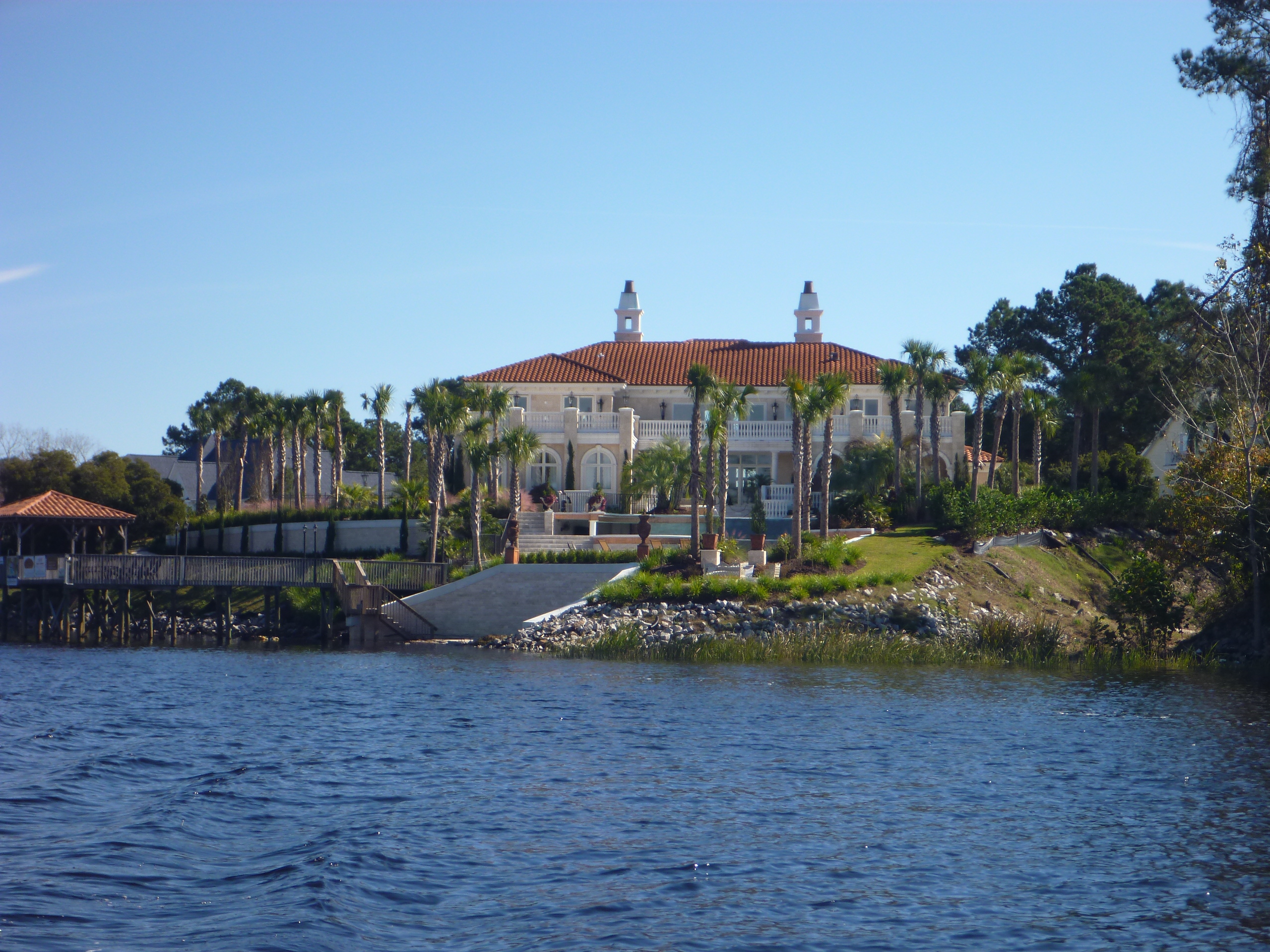
Once in the large and somewhat busy harbor we had to find the specific markers to guide us to the stretch of the harbor where the marina we were going to stay at was located.

Fort Sumter
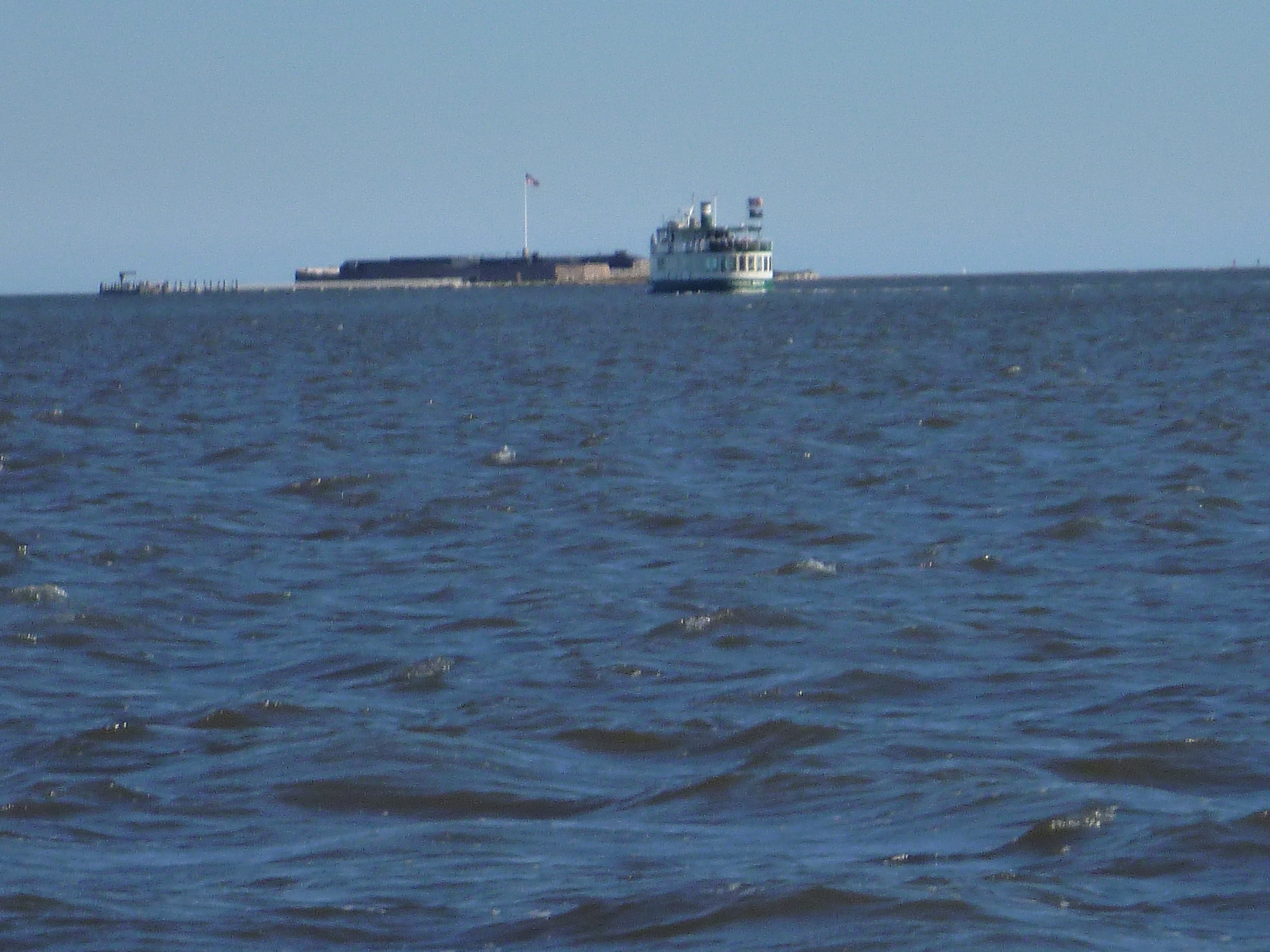
During this we passed by Fort Sumter where the Civil War began.

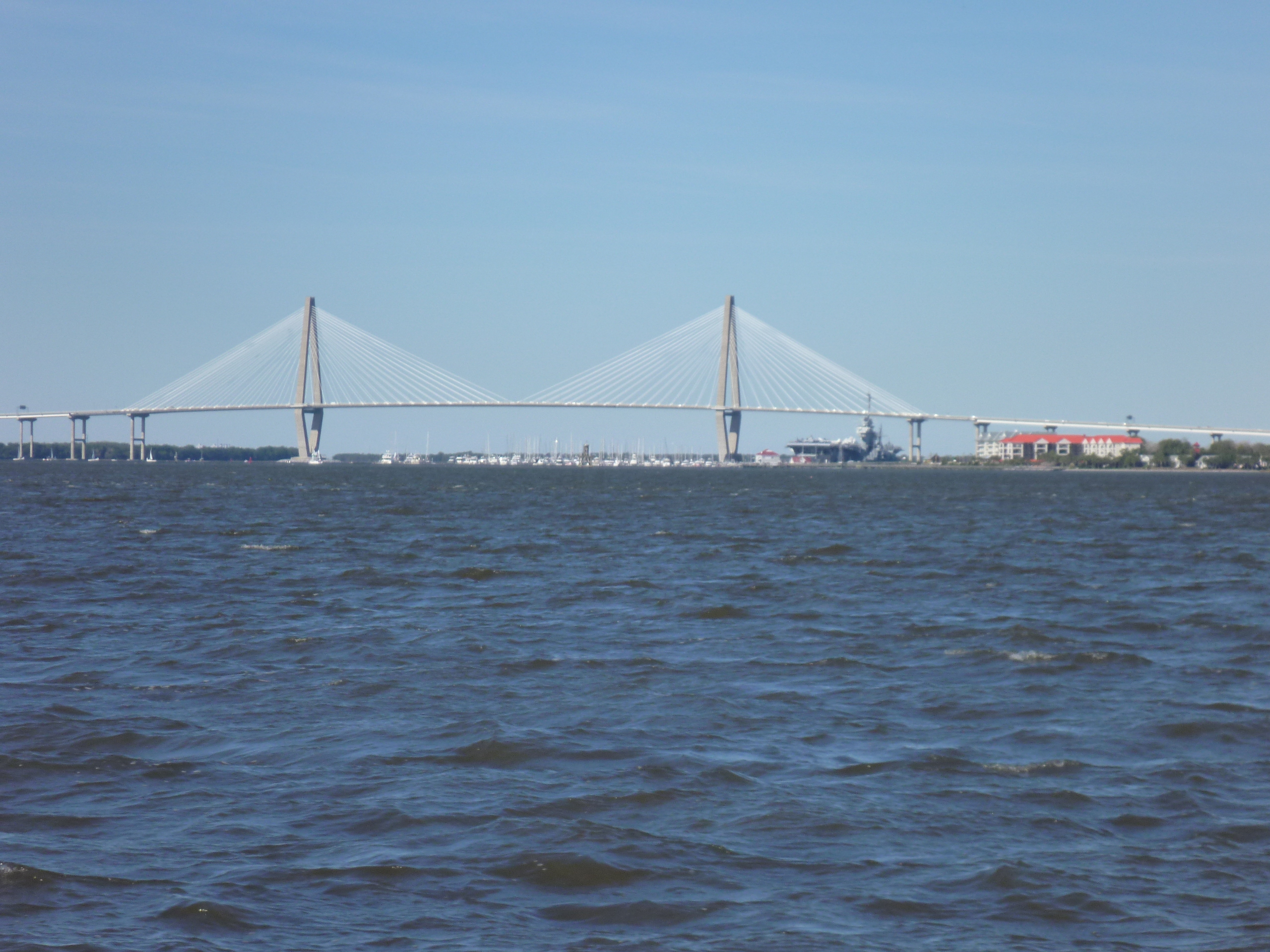
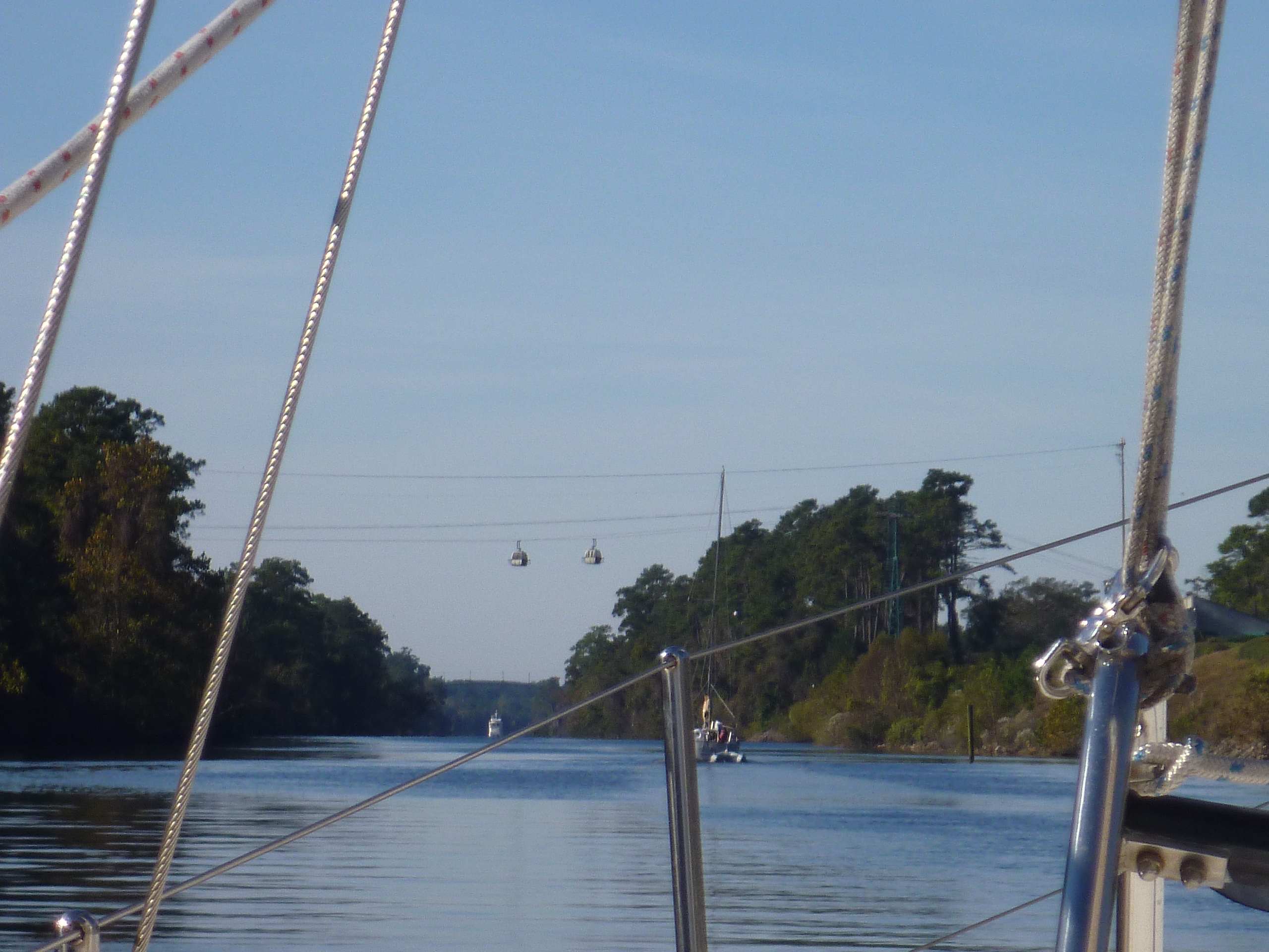
And passed the Charleston skyline.


Charleston skyline
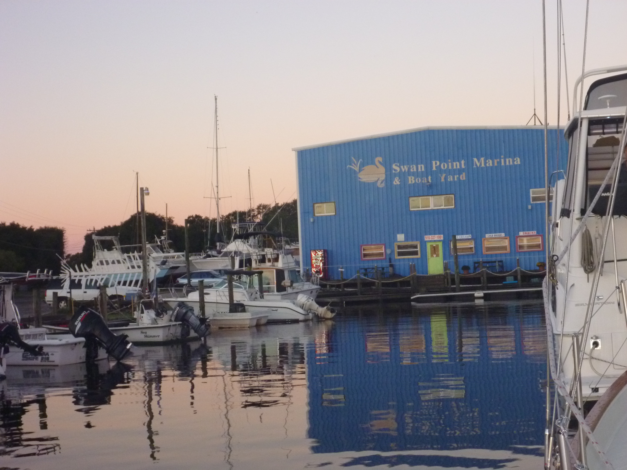
We called the marina to let them know we were less than an hour away so they would know we were coming.  We were told which slip we were being assigned and on which side to prepare our lines and fenders.  As we approached we heard 3 other boats trying to hail the same marina on the radio informing them that they were approaching.  With apparently only one dock hand on duty, the marina was not responding very quickly and everyone was instructed to hold off until they could provide assistance with the docking.

This meant going up and down the harbor along the marina while avoiding boats under sail (they have the right of way), small slower boats, and fast larger boats all milling in the same space.

We checked out the slip we were being assigned and saw another boat already there.  So, amidst all the other confusion the marina and we were dealing with, alternating between telephone and radio, they needed to figure out what had gone wrong, and where to put us.  They eventually assigned us a new slip, assisted us, and we were tied up to the dock with no further incident.

Individually the day’s events probably wouldn’t have been a big deal, but these small events just added up, resulting in a day that turned out a bit more stressful than anticipated.  Bob needed a beer.

Sunset 1
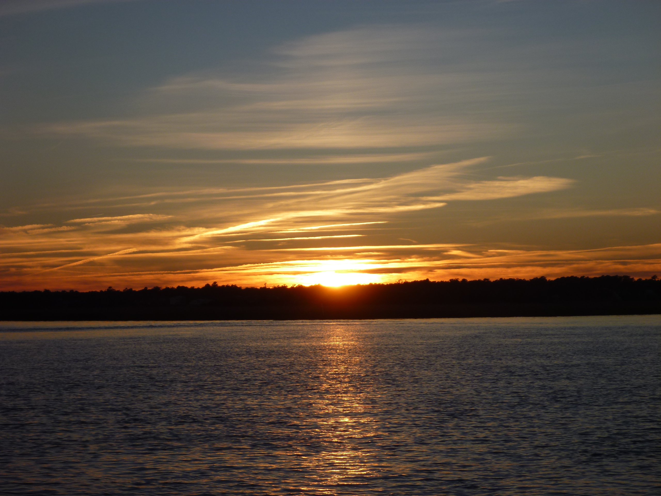
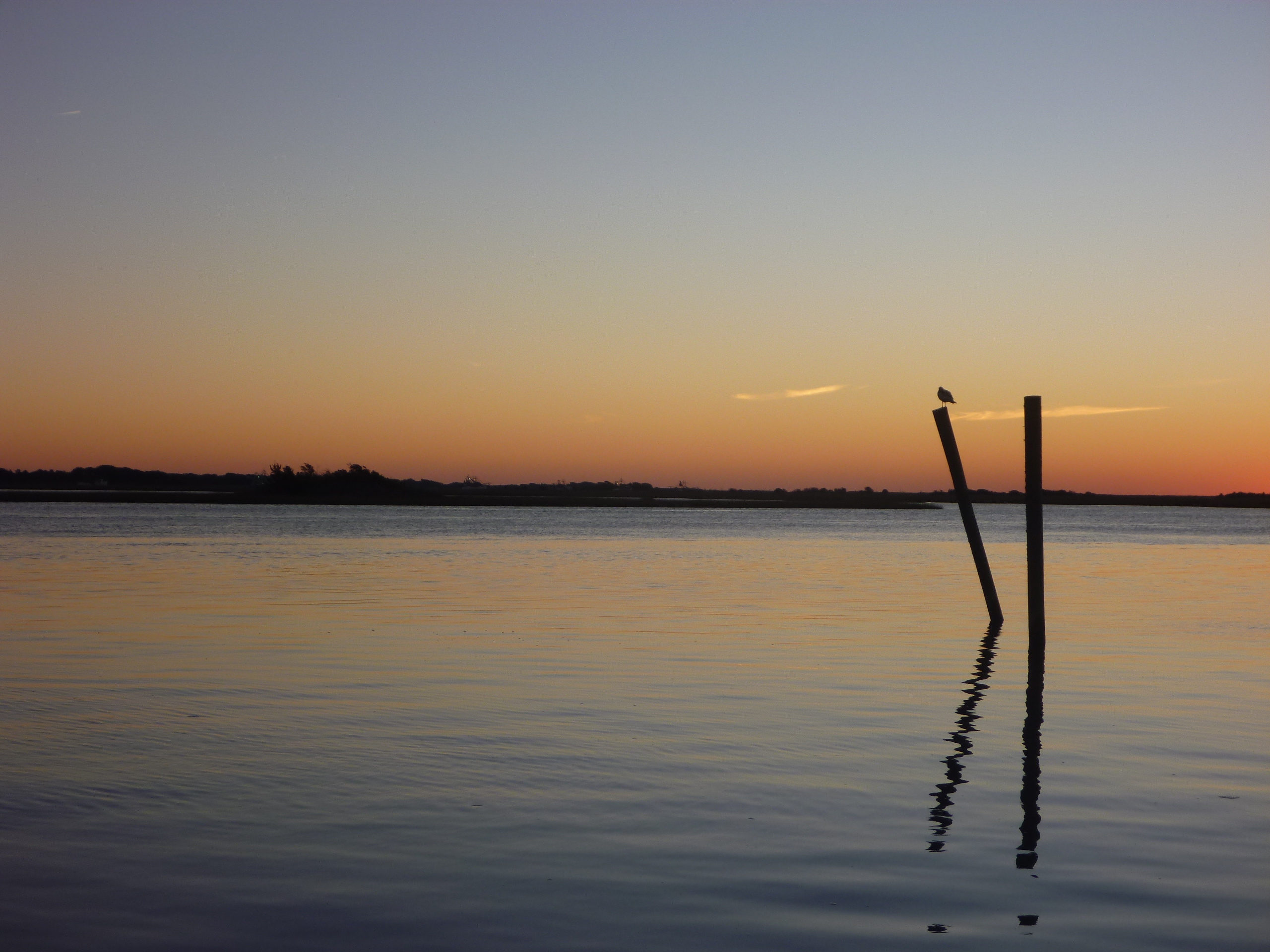
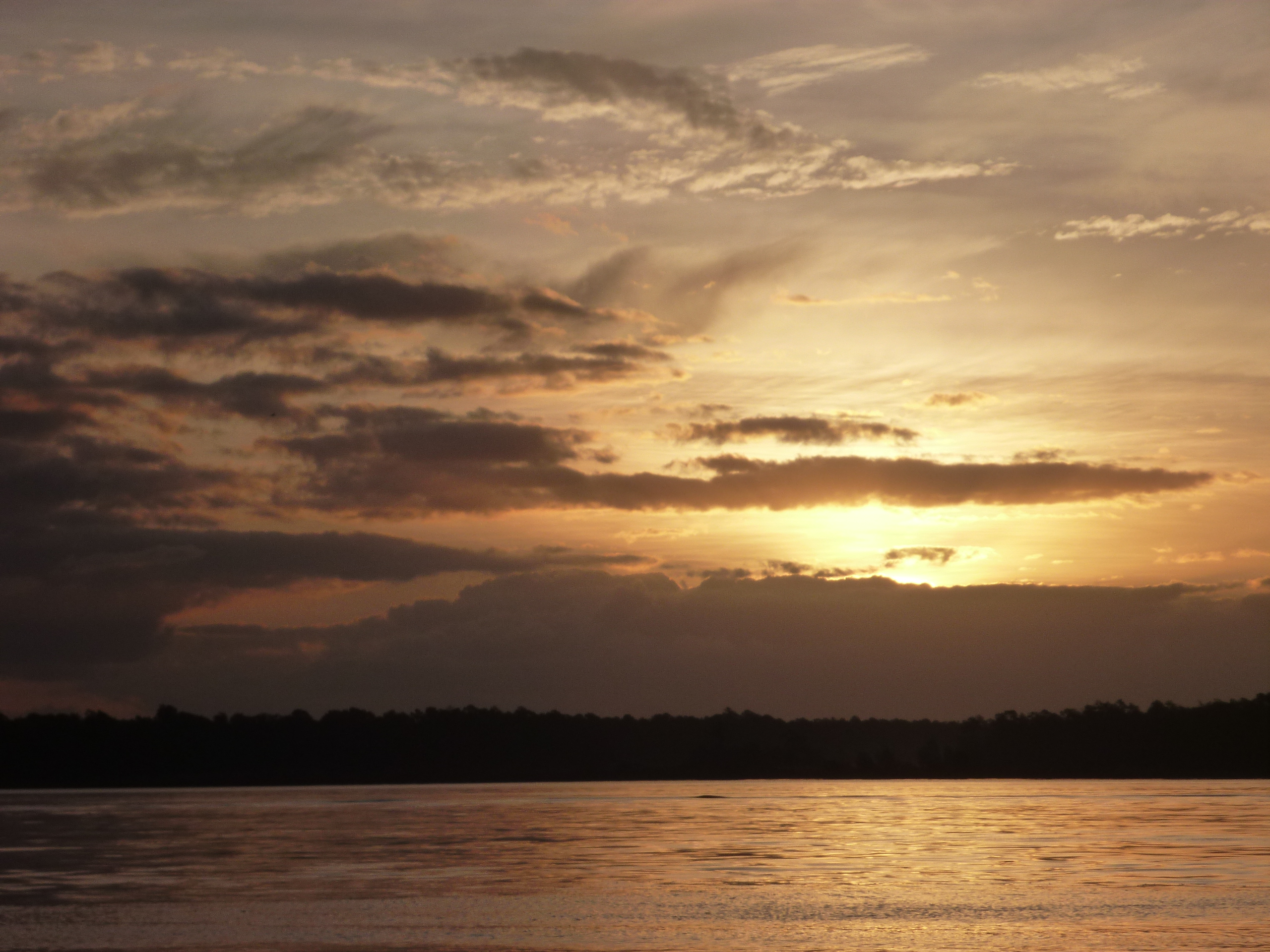
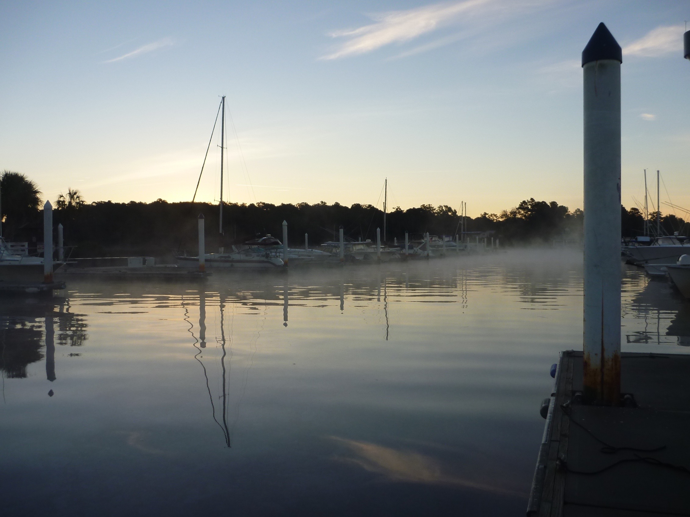
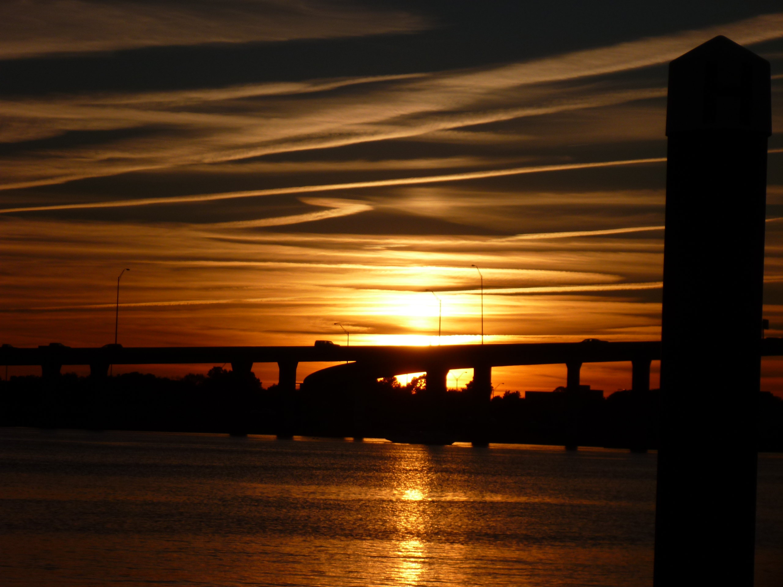
A fellow Gozzard owner we met back in April calls this marina home and we caught up with him for a sundowner, enjoying a magnificent sunset from the cockpit, before heading to the complimentary happy hour the marina hosted.Sunset 3 (1)Sunset 2 (1)

During the season this marina hosts happy hour 4 days a week, and we just happened to arrive on the day of the last one for the season.  Free beer and wine was on offer as was a full Thanksgiving dinner spread of cornbread, turkey, stuffing, potatoes, sweet potatoes, green bean casserole, corn, cranberry sauce, and pumpkin pie.  Needless to say we did not need to go to town for dinner – we’ll explore Charleston tomorrow.

Sunset 4

Our longest day…..so far

Wednesday, 18 November

SunriseWe knew that today would be our longest day so far on the trip with plans to cover over 55 miles.  We allowed for the possibility of this day taking 10 hours, but with a favorable strong current and by unwittingly timing our travels with high tides we were able to make the trip in 8 hours leaving Georgetown, South Carolina at 0630 and arriving in Isle of Palms at 1430.

Bird by water

We always enjoy seeing the different birds along the way, and this day was no different.  Here are some of our fine feathered friends of the day.


Birds Bird dock


We were naively hoping for a day as stress-free as the prior one had been, but, as we transited the Waterway the ActiveCaptain app on the iPad kept warning of us shoaling areas.  And for these Bob slowed down the boat and tried to find the deeper water.

There were multiple times where the depth indicator showed a depth of 7 feet.  Since the tides run 4 feet in this area we really wondered what the depths would have been if we were transiting on a falling or low tide.

DredgeWe did see a dredge on the water (although  not operating at the time) and another being towed by a tugboat with four additional tugs guiding it.  This thing was long!

Tug and dredge equipThis first photo is as it approached us, and the next one is from the rear of the whole contraption with multiple barges and pipes/hoses extending out the back.  It seemed to be at least a quarter of a mile/.4 km long.  It was an amazing sight.  Near the end

With these dredge sightings there is hope that on a future trip up or down the Waterway there may be fewer shoaling areas to concern us….here’s hoping.

Marsh lands


The scenery changed along the way and gone were the cypress trees and the marshes made their appearance.

Thankfully the strong currents don’t apparently  turn the corner to make their way to Isle of Palms Marina and when we arrived we slipped easily into our assigned slip with no incident or dramas.

Our original plan was to make our way to Charleston, South Carolina the next day, but in looking at the weather forecast we discovered that tomorrow is forecast for thunderstorms and 100% chance of rain.  We decided to spend an extra night here and not have to deal with Charleston currents and boat traffic in less than desirable conditions.  And because we had done most of our boat chores in Georgetown, this means we would have a day of total leisure if we wanted.

We ran into some friends from our home marina in Rock Hall, Maryland and it was great to reconnect.  They are taking a more direct and quick journey, planning to arrive in Florida in 3 days while we will continue to make our way slowly and enjoy discovering the sights and towns along the way.

Bob spent the next morning realizing that we may need to modify our initial travel plans as he mapped out the necessary timings for bridge openings as well as tides and currents for most efficient passage making.  The result?  We will be adding a few more days to our transit through South Carolina.  Nothing wrong with that – we both are enjoying our time here.  

A Most Blissfully Peaceful Day….

Monday – 16 November

TreesIt was a most awesome day today meandering down the Waccamaw River in South Carolina — wide, deep and peaceful as we floated past Cypress filled woods.  We only saw 3 other boats all day and the radio was uncharacteristically quiet.

WaterwayHonestly the most peaceful day on the boat on this trip — I’m not saying others were always stressful, but today was just truly blissfully peaceful.


The water was so calm we could see the reflections of the trees in the water.

Trees and cloudsWe caught a favorable current and at one point we were going over 9 MPH / 15.5 KPH with the RPM’s at a nominal 1500.

We arrived in Georgetown, South Carolina ahead of schedule and enjoyed two relaxing days in this very quaint and friendly town.

On Wednesday we plan for our longest day yet with over 50 miles / 80.5 km with unknown currents and shoaling.  Stay tuned for more details….


A Gorgeous Day….

Sunday 15 November –

We had a relatively short day planned today and allowed for a leisurely start to the day, but again we were up and ready to go by 0700 and so we did.

Morning mistToday was the first time we woke up to frost on the dodger (windshield/windscreen) and on the dock.  We are determined to get to warmer climate soon!

But the day warmed up nicely and we were delayered and shedding the shoes by the time we reached the next marina for our evening stay.

Shortly after leaving in the morning we went through the first of 3 bridges that needed to have an opening requested.  We ended up following the same sailboat all day, and although we didn’t converse much, it was nice to have him lead the way.

The rock pileThe first (and really only) challenge of the day was navigating what is referred to as the Rockpile.  This is a particularly narrow part of the Waterway which is bordered by rock ledges on both sides for 5 miles/8 km or so.  It really wouldn’t be too worrisome, if those rock ledges weren’t UNDER the water, and therefore could not be seen.  Many boaters have had significant damage done to their boats by getting too close to the sides of the ledges and rubbing up against the sharp rocks.   You have to trust your eyes and stay in the middle of the Waterway.

There are a couple of wide areas in this 5 mile/8 km section, but otherwise there is no real space to pass tugboats, barges and other commercial vessels.  So, as is recommended by the cruising guide, Christina put out her first Securite message on the radio.  (There are three international radio warnings that get broadcast to all stations: 1)”MayDay” for distress or life threatening situation aboard – please send help.  All commercial vessels are required to respond in the area.  2) “PanPan” is used to convey urgency on board  but no immediate danger to life or vessel – don’t send help but be advised of the situation.  (We have heard a few PanPans issued by the Coast Guard for unmanned dinghy in the channel, distress calls they have received with no location, etc.) and 3) “Securite” for safety messages, indicating there is some hazard or something different than normal.)  The Securite message boaters are advised to send out for the Rockpile is to state your vessel is entering the Rockpile from which direction and request information regarding any vessel entering or transiting the narrow passage from the other direction.

With the Securite issued we proceeded down the Rockpile, hoping for the best.  Following the sailboat in front, we were pretty comfortable until as we reached the most narrow portion near the end, another sailboat approached from the south heading straight toward us at full speed.  Bob, at the helm was not impressed and a few expletives were uttered.  Christina tried to hail the oncoming boat on the radio, but they either had their radio turned off or not on the hailing channel of 16, because they didn’t respond.  We ultimately slowed down and veered a bit to starboard to avoid them, hoping we weren’t going to hit the rocks.  We don’t think they fully understood why we weren’t too friendly as they passed by.  Thankfully it was just a stressful moment and nothing else.

Tide StationNear the southern end of the Rockpile you will see this.  There are no signs, but the chart listed Tide Station near this location.  So we are assuming that is what this is.
Water height


We left the Rockpile, and went through our second bridge opening of the day.

South Carolina has been subject to severe rains and ultimate flooding recently, and with that, the water heights are reportedly 4 feet higher than usual.  This board indicates the number of feet of clearance to the bridge.  This usually reads about 66′ and today it was 62.5′.  This was no problem for us but we do have friends with masts that are 62.5′ and wondered if they scraped as they passed by the prior day.

Signs of floodingWe think these trees are usually on land and not in the water – another sign of recent flooding.

Houses


From there we enjoyed the warming sunshine as we meandered past golf courses and very expensive looking homes.

Big house Gondolas South Carolina is known for its many golf courses, and one even has a gondola that crosses the waterway with enough clearance for sailboats to pass safely underneath.

Passing gondola


All the charts indicated there was enough clearance for the mast to pass under the gondola, but Christina wanted to make sure, especially with the higher than usual water.

Also along the way is a dock where you can tie up your boat at the outlet mall.  Very convenient.  But, Bob couldn’t be persuaded to go shopping and so we continued past…..maybe on our way back North?

This is not as close or where we really wanted to be passing a barge as we went under the third bridge today.

Passing Barge

Bobs viewBob is at the helm 99.99% of the time, and so he wanted to share his view of the world these days.

We left the land of golf courses and mini mansions and entered the land of cypress forests as we approached our marina.

Entrance to OspreWe decided we found a real gem of a marina on the ICW  at Osprey Marina.  We navigated through this small channel and were greeted by a very helpful dock master who assisted us in tying up in a slip….twice.  The first slip was a bit too short for us and our long bowsprit, so he moved us to a longer slip where there was no danger of our anchor taking out electric pods or fire extinguisher posts.

When we checked in we were given a “goodie” bag which was quite fun.  It contained pastries, crackers and local jam, along with another can cooler (we can never have too many of those!) and other useful assorted goodies.

The marina is nestled in the woods and was a very peaceful delightful place to spend the rest of the afternoon and evening.  We highly recommend this sanctuary to any one considering transiting the ICW.

Tomorrow is another short day as we head to Georgetown.

Goodbye North Carolina – Hello South Carolina

Saturday – 14 November

Southport was a lovely stop along the way.

We planned to leave the marina a little later than usual as we tried to time our travels with the tides and currents.  But we were ready to go by 0730, and off we went.

A cold spell has made its presence known, and layers were worn as were shoes and socks!  (We are looking forward to putting the fleece and shoes away soon!)

Today was a pretty uneventful day, but very relaxing as there were no bridges to schedule around, and very few shoaling areas to navigate around.  But each of the four inlets we passed through were more challenging than expected with whitecaps on one.

Slide in the water croppedWe passed by beautiful homes, many with private docks for small power boats.  This particular house created their own waterpark with slide into the water.

Unwanted landmarkToday’s landmark of distinction was this half sunken boat, still tied to the dock.  Reportedly, it has been like this for years making us wonder what really happened to it and why someone hasn’t cleared it out.  It is not really a hazard to traffic on the waterway, but still something to avoid so we don’t have a similar fate.

The narrowness of the “ditch” is becoming commonplace and easy enough to deal with.

The marina we chose for the night is literally right on the ICW, so even with a strong current we were able to pull up alongside the dock easily.  The marina is small, but the restaurant looks to be top notch and we will plan to be enjoying happy hour libations and good food before retiring for the evening.

A Pleasant Day on the Water….

Friday – 13 November

pelicans on postsLeaving Wrightsville Beach near high tide, and keeping the markers to port, we successfully navigated the shallow channel and back into the ICW.

There was shoaling at every inlet today with challenging currents.

When you approach Carolina Beach it could be easy to misread the charts and proceed straight.  But to stay on the ICW you must take a right at G161 and enter Snows Cut.  There is a tall bridge that usually has 65’ clearance, but as the tide was high when we passed under there was only 63’  This was no problem for us as our mast is around 55’.  But later, on the radio we heard other boats needing to wait at this bridge for lower tide with concern that they would not clear the bridge.

So, if it is not the depth, it is the height you have to also worry about traversing the ICW.

Cape Fear RiverWe proceeded down the Cut winding our way through a slalom course of markers before it opened into a wide tributary channel of the Cape Fear River which although appeared to be a large expanse of water, was actually a narrow channel to stay in.

genoaOnce this was cleared we were in the wide Cape Fear River with 45 foot depths.  We rolled out the genoa and motorsailed with a favorable current and good wind, on a crystal clear 70 degree day we were making 8 mph (this is fast for us).

Active Captain warned of a misleading red marker in the middle of the channel that, if followed, would take us up a different  channel to the Military Ocean Terminal Sunny Point, the largest military terminal in the world.  It serves as a transfer point between rail, trucks, and ships for the import and export of weapons, ammunition, explosives and military equipment.  We read that if you do find your way up that channel, you are greeted by a US Navy gunboat.  We decided not to go there.

A bit closer than we wanted
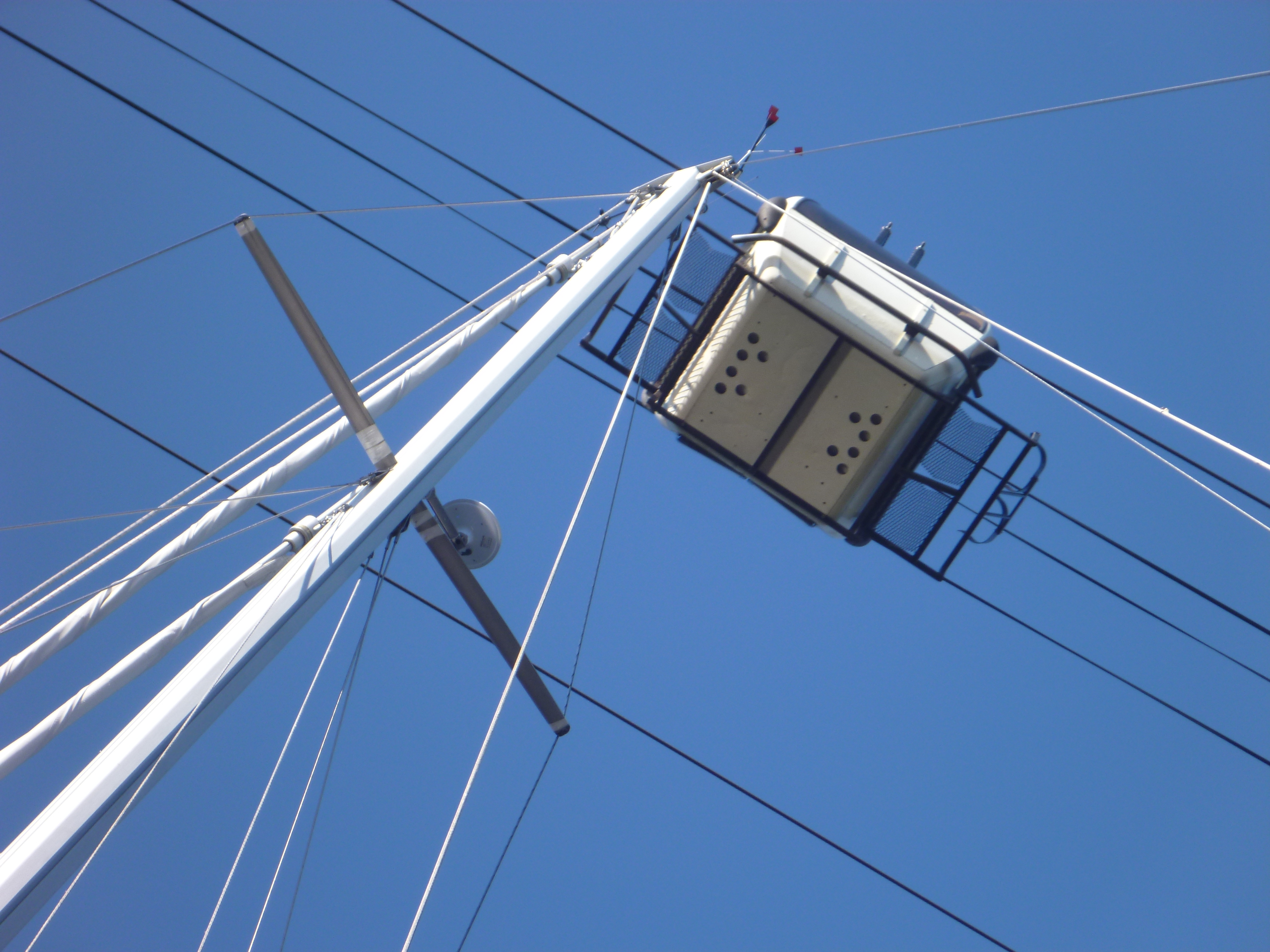
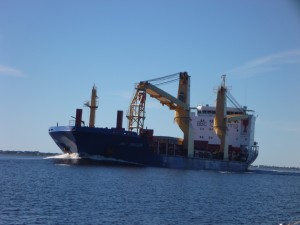
We saw this big container ship with cranes from a distance, and before we knew it we were passing a bit closer than expected.

We left the expanse of the river and turned right back into the ditch of the ICW.  Immediately after this turn we entered Southport Marina where we would spend the rest of the day and evening.

We arrived before noon and enjoyed an afternoon of exploring the town.

Tomorrow we leave North Carolina and enter South Carolina arriving in North Myrtle Beach.

Patience is a virtue

Wednesday – 11 November

This day was a day of waiting.

We left Swan Point Marina as the sun was rising.

By 0715 we heard of the first grounding back at G61 – G63 on the radio (the site of yesterday’s excitement).  Shortly after that we watched another boat ground ahead of us as they drifted slightly to the left of the channel (this just happened to be the same boat that rammed our dinghy in Beaufort the prior morning – we are not making any comment here – just an observation!).  Many cruisers tried to offer assistance but as we listened for the next hour or so, every effort was to no avail and we think they ended up calling the towboat for help.  We never heard from or saw him again that day.

Swing bridge  openingThis was a day where timing was everything.  We had to pass through 3 different bridges, 2 that opened only on the hour and 1 that opened on the hour and half hour.  As is our way, we kept down our speed so as to arrive at the bridge(s) close to the scheduled opening times so as to reduce the amount of time we have to wait and mill around with all the other boats.

But with a strong current pushing us along, we inevitably arrived at each of the bridges with 20 – 30 minutes to wait.  As we would putz along the Waterway at a slower rate, all the other boats powered past us, and we wondered why they would want to do this – but to each their own.  It is much less stressful for us to come up at the rear of the parade of the boats waiting for the bridges to open.  We always radioed the bridge tender to let them know we were there, telling them we were at the back, and then again once we cleared the bridge so they would know to keep an eye out for us before closing the bridge again.

At the 2nd bridge one of the sailboats that had powered past us, was drifting, waiting for the bridge and apparently drifted onto mud on the green side.  (We had read to stay toward the red side of the channel and had no problems.)  As the bridge opened and all the boats started to move forward we saw him just sitting there – he was grounded.  We motored past him as he scrambled to get off the shoal.  If he didn’t make this bridge opening he would have to wait another half hour for the next one and then another hour for the bridge following this.  As we said….timing is everything.  Somehow he was able to get off the shoal in time to clear the bridge before it closed.

The channel was narrow at times and there were a few shoaling spots where we had to navigate through small markers that appeared to be off to the side of the channel.  Thanks to Active Captain we were prepared for these, and also aware of when it was best to favor the red side versus the green in a few more spots.

GiraffeWe are also are relying on a cruising book which highlights some of the unique landmarks.  This was the Dead Reckoning Landmark mentioned at the 2nd bridge of the day…. a sculpture of a giraffe.

Buddah sculpture

We don’t know why they didn’t also mention the metal sculpture of the buddha holding an American flag at the same location.

Palm Tree  Island

You never know what navigational aids, if any you will see indicating a shallow area — but this “palm tree island” was mentioned as a place to avoid near the 3rd bridge.

We were told the channel to the Seapath Yact Center was shallow and instructed to keep the green marker to starboard.  Shallow indeed as our depth reader showed 5.9’ at one point.

We were given misinformation by the marina and told to leave the next marker to port.  That meant again very shallow water, and we later learned that leaving that marker to starboard provides much more depth….we will remember that for our departure in two days.

We enjoyed two nights in Wrightsville Beach, North Carolina, which seems like a lovely place to live.

sunset

A Challenging Day

Tuesday 10 November –

After a night of rain and wind, we awoke in Beaufort to what looked like promising weather for the day.

Challenges began before we even left the dock.

As we were preparing to get underway, a boat started to leave their slip behind us.  The current was strong as was the wind, which formed strong opposing forces.  Unfortunately the boat behind us misread the current, thinking the wind would blow him back into his slip, so he compensated a bit and as he backed out and made the turn to go down the fairway he found himself being pushed sideways, and unfortunately right into the back of our boat!!!  I looked up and saw him coming right at us and expletives were expressed.  Fortunately we have a rubber inflatable dinghy hanging from davits on the back, and the dinghy took the entire impact, and there was no harm or damage done to either.

The good news from this encounter was that Bob now had a much better understanding of the direction and strength of the current, which allowed us to get off the dock with help from a neighbour and no dramas.

01 - Leaving BeuafortWe left the marina around 7am along with a parade of other boats.  We successfully retraced our navigation through the channel, turning back into the ICW.

It was another day of going from marker to marker, and the weather going from warm and sunny to cooler and rainy and limited visibility.

We started playing with the iPad app, Active Captain, a bit more seriously, reading of the known hazards and shoaling along the way.  (Active Captain is a crowd sourcing application where other skippers make comments of hazards and observations (think TripAdvisor for the waterways).  It makes for an excellent additional tool in the tool box of navigation along with charts, electronic chart plotter and cruising guides.)

Ever since dinner a week ago in Elizabeth City, we have been hearing from other cruisers of problems and challenges navigating around markers G61 through G63.  We kept hearing what seemed to be conflicting advice regarding this trouble area….some saying to hug the red side, and others saying to hug the green.  There were probably over 20 comments on Active Captain about this area as well.  But with all that, we still didn’t know exactly what to expect.

As we were nearing the area we heard on the radio how a boat had run aground.  Reportedly this boat draws 3 feet….we draw 5…. That definitely got our attention.  We listened to the chatter on the radio as other boats tried to figure out what had happened and where to find the deeper water in what is a very narrow and tricky manoeuvre of a tight “S” curve.

We heard a familiar boat who had transited the Dismal Swamp with us on day two of the ICW journey and who had offered us assistance when we had run aground and who now had transited this trouble spot successfully.  So we hailed them on the radio to get as much detail as possible as to what works and what to avoid.

The more we learned, the more we realised we would be arriving at this location at the worst  possible time of low tide when the water would be at its most shallow.  Could we have planned this better?

When we approached, only the grounded sailboat was still there (waiting for the tides to come in to lift them off the shoal) so we didn’t have any one ahead to follow through the area.

We radioed the grounded vessel to confirm the best path around.  There were two small markers (one red and one green) far to the right, looking to be off the channel and close to the marsh.  If he hadn’t been sitting where he was, we most likely would have made a similar mistake because the markers really do look quite out of place.  It looked like following them would take us into shallow water.  But he confirmed, and confirmed again, … and one more time as we continually questioned it, that we needed to go across his bow and head to the small markers and be sure to keep the right one on starboard.

Okay…..here we go.  Everyone had said to hug the green marker after making the turn, but we weren’t sure if it was the first green or the second they were referring to.  We cleared the red marker and made the turn to pass the green on our left, but how far away should we be for deeper water?  We erred on the inside, and did indeed bump the ground, once, twice,and three times, but each time she took the bump and kept on going….the last one took faith and a prayer.

We celebrated when the depth reader finally showed 6 feet.  We continued toward the next green completing the “S”.  We both took deep breaths of relief and continued on.

During all this we were passing along Camp Lejeune Marine Base, where Bob called home in the ’70’s when he was stationed there.  It was also the 240th birthday of the U.S. Marine Corps on this auspicious day.  Happy Birthday USMC!

Warning signThis part of the waterway is often closed as the Marines do field practice with live rounds, and there are signs along the way warning of undetonated explosives on shore.  We had called ahead the day before, and knew there would be no such activity, so we weren’t too worried about having to coordinate around these exercises.

Once we cleared the tricky area, we approached a bridge that only opens on the hour and half hour.  We radioed ahead and told the bridge tender where we were, and were advised we would need to wait for the next opening in another half hour.  We slowed down and enjoyed the quiet scenery as we waited.  About twenty minutes later, the bridge tender warned us if we didn’t get a move on we would also miss the next opening…. Oops…. Better push down the throttle.

We continued another six miles to the marina where we planned to spend the night, but the last 1.5 miles were filled with additional hazards and warnings of shoaling.  Thanks to Active Captain, we knew when we needed to hug the red side, and when to hug the green, and passed through without incident, but not necessarily without stress.

Throughout the day we did have multiple encounters with dolphins and that is always a nice diversion.

MarinaWe ended the day at Swan Point Marina, which touts itself as the friendliest marina on the ICW.  It was indeed a friendly marina, with the manager offering to drive us to a local restaurant for dinner, or take go into town to pick up anything we might need.  The marina itself is a bit old and could benefit with a little TLC, but it had all the amenities necessary.

Before heading to the bathhouse for a shower, we sat in the cockpit and planned our trip for the next day.  There are 3 bridge schedules we have to plan for, and a few shoaling hazards which may slow us up.  But hopefully we will be prepared.

SunsetWe were rewarded for all the day’s challenges with a beautiful sunset.

As we enjoyed a dinner on board (Bob had soup and Christina devoured her left over shrimp and grits……very yummy!!!!) the winds picked up with amazing force.  When we checked the National Hurricane Center website we discovered there was indeed a named tropical storm off shore of where we were…..oops…. we should check that website more often!  The forecast models all showed the storm going out to sea overnight, but we weren’t sure if there would be any residual wind we’d have to deal with the next day.  With that we made it an early evening, and went to bed early.

If all goes as planned we will be arriving at Wrightsville Beach tomorrow afternoon for two nights.

It’s not all sunshine and palm trees…..

Monday – 9 November

P1020489

We woke up to rain….lots of rain.  We knew it would be a wet day on the water.  We left River Dunes Marina in Oriental, NC before 7am and headed toward Beaufort.

P1020490

Just a sidenote to anyone who thinks boating is a time efficient means of travel along the coast…. from the marina it took us 10 minutes to get to Oriental, NC by car.  By sailboat we passed by the town 1.5 hours after we left the marina.

It rained all day so visibility was a challenge…. and today we had to navigate from marker to marker through a curvy narrow channel….this meant Christina with the binoculars and Bob at the wheel with the constant question of “do you see the next marker?”.
In the middle of this process a small pod of dolphins (6?) played in the water near us.  No photos this time as we had to focus on finding the next marker.
And then we went through the busy channel of Beaufort where markers from multiple channels converge, and the navigational aids (green on port / red on starboard) reversed for some channels so we weren’t sure which buoys and markers we were supposed to steer toward and keep to which side, add to that a wind that kicked up toward the end and rain that got harder…and oh yes, the tide…. the tide is strong here at Beaufort Docks and we tried to time our arrival for slack water (between tides)….but looking out at the water there was still very strong current – we even saw whitecaps!
Needless to say it was a bit stressful for Bob as he steered.  But we got to the slip and safely tied to the dock with no incident.  And a beer was in his hand within minutes to help relax.
And still it rains….. hard.
Tomorrow we are scheduled to take off again for Swan Point Marina on our way to Wrightsville Beach, NC, but Thunderstorms are forecast for the morning….so….. who knows?
The dockage fee is quite expensive here (surprisingly) but depending on the weather forecast we may spend another day…. stay tuned….

Three days in Oriental, North Carolina – not complaining

Friday – 06 November

House

The day started out gray and gloomy but by mid day it was a gorgeous sunny day with a beautiful favourable wind that enabled us to unroll the genoa and motor sail for a bit.  By taking advantage of the wind we were able to go faster and reduce the engine RPMs thus reducing fuel consumption.

Fuel consumption is not that great of a concern as Bob was pleasantly surprised that after 4 days being on the move he was hard pressed to put even 15 gallons/57 liters of diesel in the tank.  As we watch the powerboats whiz by us, it is hard not to compare the fuel costs of those bigger engines and of our sailboat that also takes advantage of the wind.

A lot of the rivers in North Carolina are larger than we expected and we find ourselves farther from land than you would think.  But…. the rivers are also quite shallow so even though there appears to be a vast expanse of water, we are limited to where we are able to go and are restricted to at times a pretty narrow channel within.

shrimp boat

The sights along the way varied from houses along the shore, to woods and even a working fish house which offers very economical dockage for transients.  Something to consider for our trip back up in the Spring, but the aroma of the fish house may definitely deter us.

Dock

Approach to marina

Our destination was to be River Dunes Marina on Grace Harbor.  The approach is a man-made channel with an entrance that is almost hidden.  Thankfully there were channel markers guiding the way, but even with those we questioned if we were heading in the right direction.

marina

The marina is nestled in the midst of an extensive housing community that is still being developed.  The marina plays hosts to boats of all size and type, including mini-mega yachts.

We originally planned to spend two nights here, enjoying a bit of resort living and R&R, taking advantage of the pool, spas, and steam showers.  But in looking at the forecast for high winds on Sunday, we opted for extending our stay and spending a 3rd day safely tied to the floating docks with full finger piers.

Marina from land

Saturday ended up being a delightfully beautiful and sunny day, and we took the opportunity to get a little exercise and borrowed a couple of the courtesy bicycles and cycle around the miles of space the community will grow into.

Upon our return, Bob opted for a nap, and Christina enjoyed a dip in the pool and a soak in the spa…..aaaah….. quite a treat.

We had reserved the courtesy car for the late afternoon and took it into the town of Oriental, NC up the road.  Did a small bit of provisioning and then enjoyed a light supper in a pub before racing back to the boat, trying to beat the rain as the sky was getting dark fast.  We did get back to the marina before the rain, but didn’t get everything onboard before the downpour….so a bit wet but with contented stomachs we hunkered down below for the evening.

As predicted, the winds picked up over night and the boat rocked and rolled while tied to the dock.  Sunday is being spent listening to the wind and enjoying a quiet day aboard.

We did venture out for one of our favorite things to do on a cool and dreary day….enjoying the hot tub/spa for a wonderful soak and jets to soothe the muscles.  We need one of these on the boat!

Tomorrow, weather permitting, we head to Beaufort, North Carolina.