Tuesday 10 November –
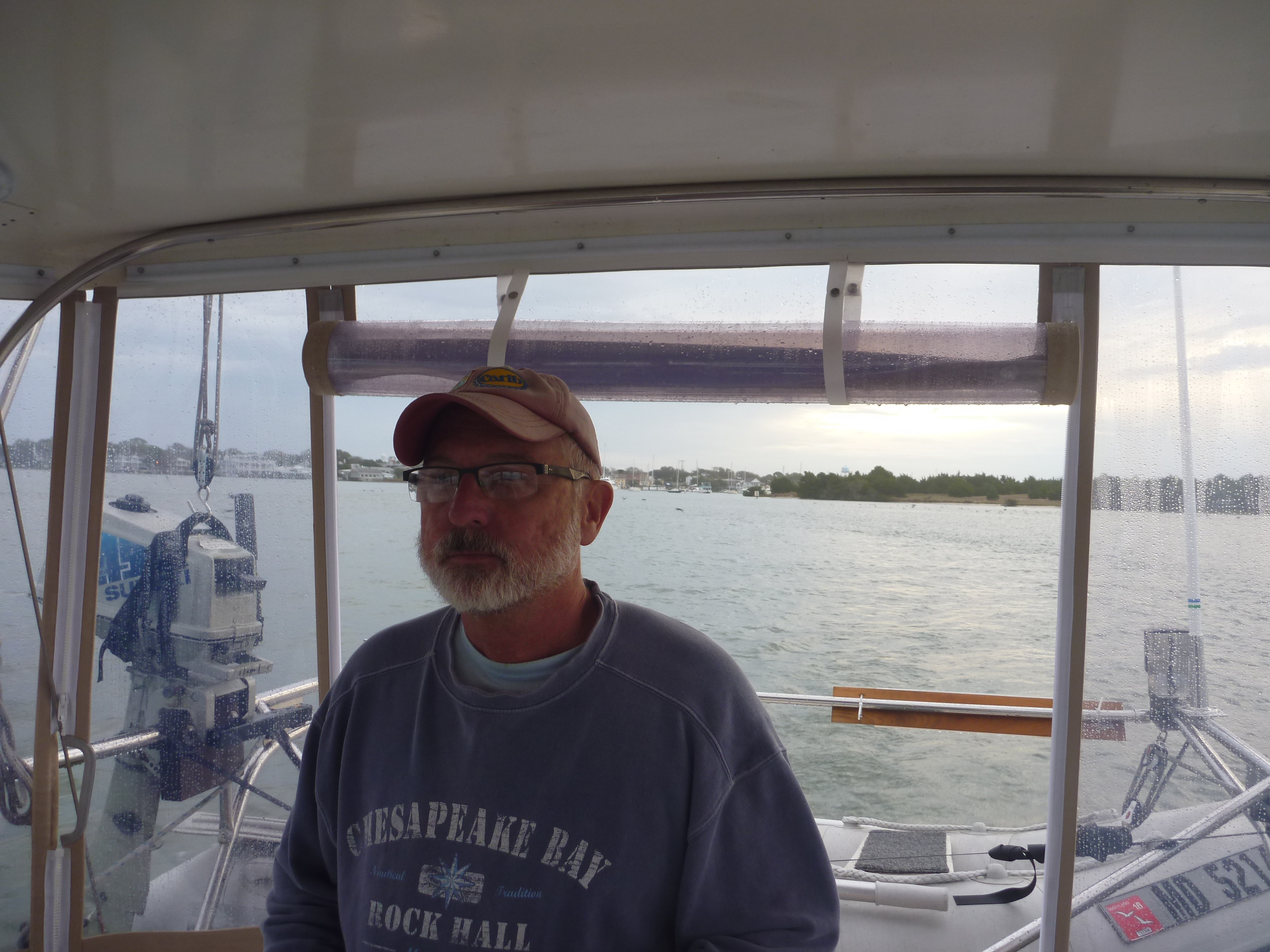
After a night of rain and wind, we awoke in Beaufort to what looked like promising weather for the day.
Challenges began before we even left the dock.
As we were preparing to get underway, a boat started to leave their slip behind us. The current was strong as was the wind, which formed strong opposing forces. Unfortunately the boat behind us misread the current, thinking the wind would blow him back into his slip, so he compensated a bit and as he backed out and made the turn to go down the fairway he found himself being pushed sideways, and unfortunately right into the back of our boat!!! I looked up and saw him coming right at us and expletives were expressed. Fortunately we have a rubber inflatable dinghy hanging from davits on the back, and the dinghy took the entire impact, and there was no harm or damage done to either.
The good news from this encounter was that Bob now had a much better understanding of the direction and strength of the current, which allowed us to get off the dock with help from a neighbour and no dramas.
 We left the marina around 7am along with a parade of other boats. We successfully retraced our navigation through the channel, turning back into the ICW.
It was another day of going from marker to marker, and the weather going from warm and sunny to cooler and rainy and limited visibility.
We started playing with the iPad app, Active Captain, a bit more seriously, reading of the known hazards and shoaling along the way. (Active Captain is a crowd sourcing application where other skippers make comments of hazards and observations (think TripAdvisor for the waterways). It makes for an excellent additional tool in the tool box of navigation along with charts, electronic chart plotter and cruising guides.)
Ever since dinner a week ago in Elizabeth City, we have been hearing from other cruisers of problems and challenges navigating around markers G61 through G63. We kept hearing what seemed to be conflicting advice regarding this trouble area….some saying to hug the red side, and others saying to hug the green. There were probably over 20 comments on Active Captain about this area as well. But with all that, we still didn’t know exactly what to expect.
As we were nearing the area we heard on the radio how a boat had run aground. Reportedly this boat draws 3 feet….we draw 5…. That definitely got our attention. We listened to the chatter on the radio as other boats tried to figure out what had happened and where to find the deeper water in what is a very narrow and tricky manoeuvre of a tight “S” curve.
We heard a familiar boat who had transited the Dismal Swamp with us on day two of the ICW journey and who had offered us assistance when we had run aground and who now had transited this trouble spot successfully. So we hailed them on the radio to get as much detail as possible as to what works and what to avoid.
The more we learned, the more we realised we would be arriving at this location at the worst possible time of low tide when the water would be at its most shallow. Could we have planned this better?
When we approached, only the grounded sailboat was still there (waiting for the tides to come in to lift them off the shoal) so we didn’t have any one ahead to follow through the area.
We radioed the grounded vessel to confirm the best path around. There were two small markers (one red and one green) far to the right, looking to be off the channel and close to the marsh. If he hadn’t been sitting where he was, we most likely would have made a similar mistake because the markers really do look quite out of place. It looked like following them would take us into shallow water. But he confirmed, and confirmed again, … and one more time as we continually questioned it, that we needed to go across his bow and head to the small markers and be sure to keep the right one on starboard.
Okay…..here we go. Everyone had said to hug the green marker after making the turn, but we weren’t sure if it was the first green or the second they were referring to. We cleared the red marker and made the turn to pass the green on our left, but how far away should we be for deeper water? We erred on the inside, and did indeed bump the ground, once, twice,and three times, but each time she took the bump and kept on going….the last one took faith and a prayer.
We celebrated when the depth reader finally showed 6 feet. We continued toward the next green completing the “S”. We both took deep breaths of relief and continued on.
During all this we were passing along Camp Lejeune Marine Base, where Bob called home in the ’70’s when he was stationed there. It was also the 240th birthday of the U.S. Marine Corps on this auspicious day. Happy Birthday USMC!
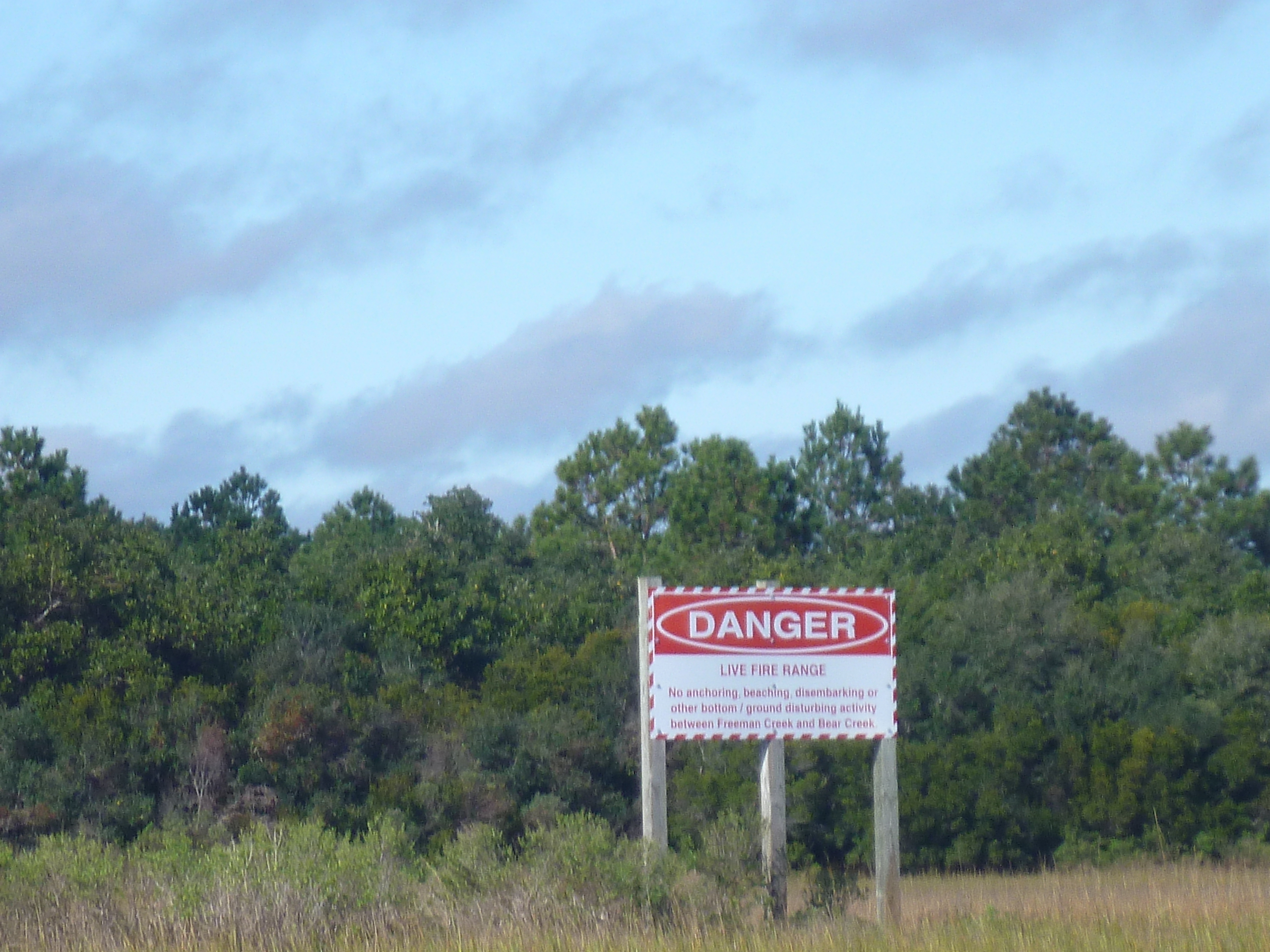 This part of the waterway is often closed as the Marines do field practice with live rounds, and there are signs along the way warning of undetonated explosives on shore. We had called ahead the day before, and knew there would be no such activity, so we weren’t too worried about having to coordinate around these exercises.
Once we cleared the tricky area, we approached a bridge that only opens on the hour and half hour. We radioed ahead and told the bridge tender where we were, and were advised we would need to wait for the next opening in another half hour. We slowed down and enjoyed the quiet scenery as we waited. About twenty minutes later, the bridge tender warned us if we didn’t get a move on we would also miss the next opening…. Oops…. Better push down the throttle.
We continued another six miles to the marina where we planned to spend the night, but the last 1.5 miles were filled with additional hazards and warnings of shoaling. Thanks to Active Captain, we knew when we needed to hug the red side, and when to hug the green, and passed through without incident, but not necessarily without stress.
Throughout the day we did have multiple encounters with dolphins and that is always a nice diversion.
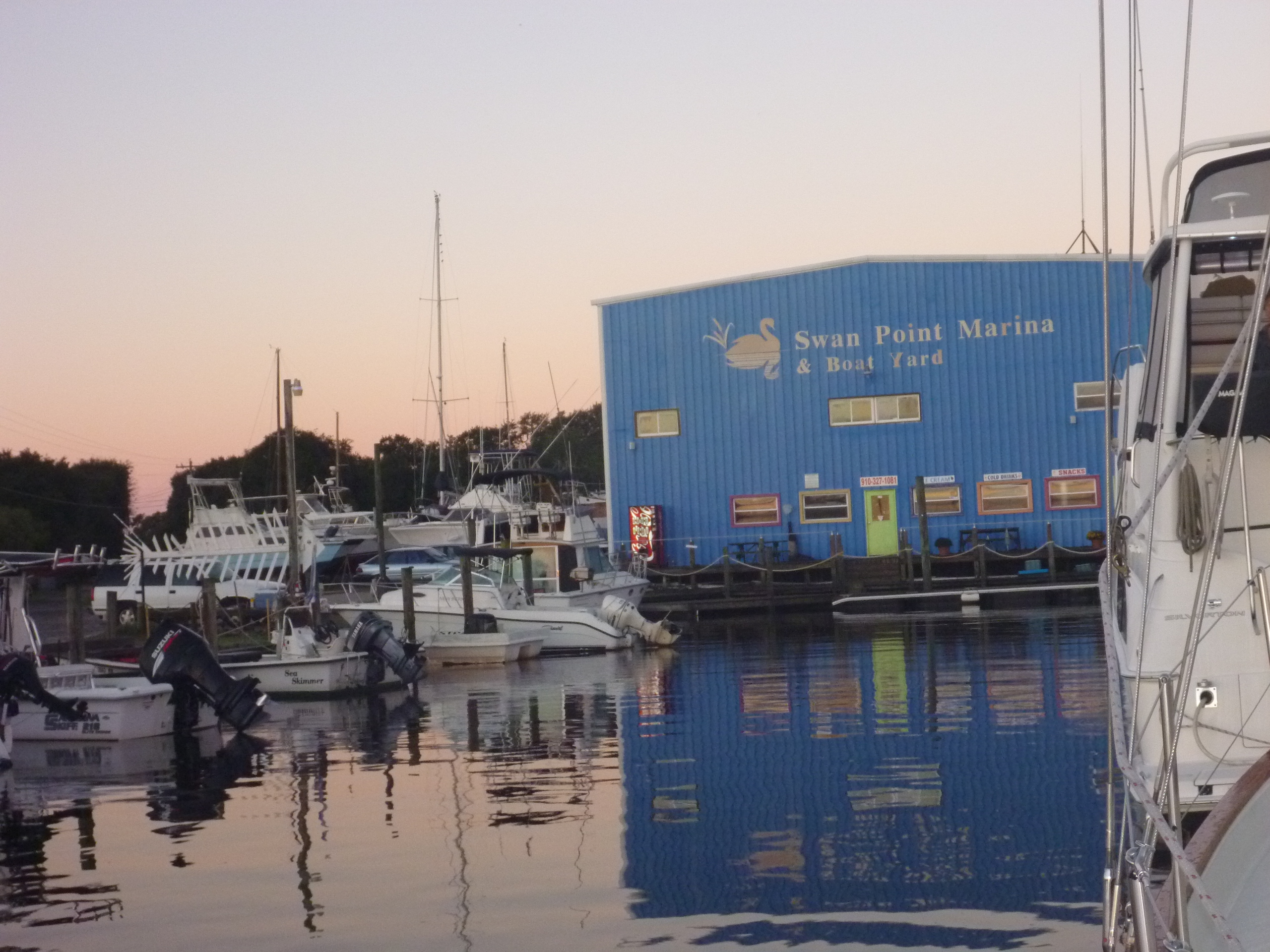 We ended the day at Swan Point Marina, which touts itself as the friendliest marina on the ICW. It was indeed a friendly marina, with the manager offering to drive us to a local restaurant for dinner, or take go into town to pick up anything we might need. The marina itself is a bit old and could benefit with a little TLC, but it had all the amenities necessary.
Before heading to the bathhouse for a shower, we sat in the cockpit and planned our trip for the next day. There are 3 bridge schedules we have to plan for, and a few shoaling hazards which may slow us up. But hopefully we will be prepared.
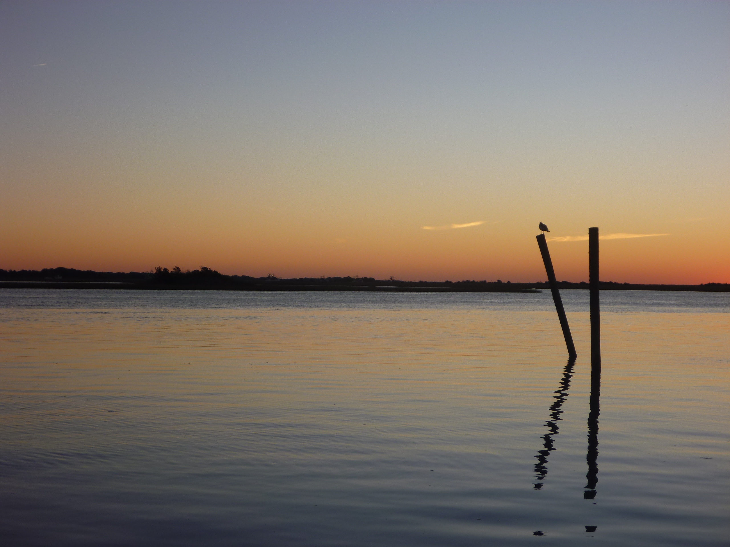 We were rewarded for all the day’s challenges with a beautiful sunset.
As we enjoyed a dinner on board (Bob had soup and Christina devoured her left over shrimp and grits……very yummy!!!!) the winds picked up with amazing force. When we checked the National Hurricane Center website we discovered there was indeed a named tropical storm off shore of where we were…..oops…. we should check that website more often! The forecast models all showed the storm going out to sea overnight, but we weren’t sure if there would be any residual wind we’d have to deal with the next day. With that we made it an early evening, and went to bed early.
If all goes as planned we will be arriving at Wrightsville Beach tomorrow afternoon for two nights.
Good for you…nice navigating skills…we’ve been there….bump, bump, bump…STUCK!…”Tow Boat!” Glad you had the opportunity to reminisce and made it to a beautiful sunset…press on!