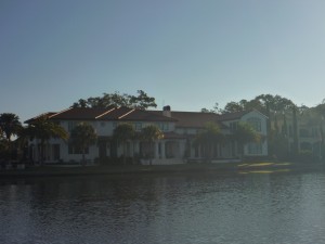
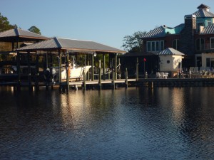
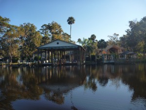
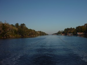
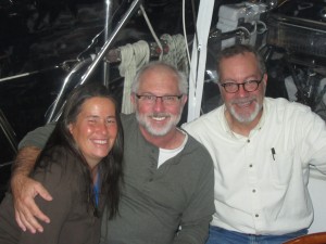
Almost 8 weeks later – We have arrived

16 December

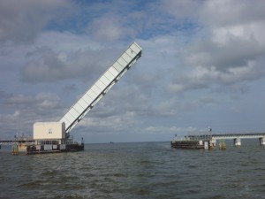
As we were making our way down the channel heading toward our last drawbridge of this portion of our journey we saw another boat following about 3/4 of mile behind.  The boat looked a bit familiar.

It wasn’t until we radioed the bridge to let them know we were a mile out and would be requesting an opening that we heard the boat behind us radio as well….it was s/v Bosco who we met back in May when we first arrived at The Sailing Emporium in Rock Hall!  We hadn’t seen them since June.

The owners are a young couple who spent the summer getting their “new to them” Island Packet ready.  We got on the radio with them and decided to catch up for dinner in Cocoa Village this evening.

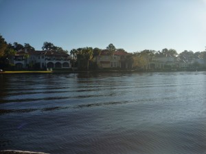
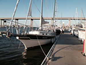
We made our way to Cocoa Village Marina in Cocoa, Florida where we will call home for the next month or two.  The weather is downright tropical and we are looking forward to staying put for a while in this warmth and sunshine.

We met up with the folks from Bosco for a pizza dinner and spent time catching up on our respective journeys, boat issues, and life on board.

The new friends who we first met in Lady’s Island on Thanksgiving, and then again in Jekyll Island, and once more last night appeared again and joined us for what turned out to be a great evening comparing notes.  We talked about how after a long time aboard, it’s nice to be with other people – especially people who share similar experiences.  The boating community is indeed a welcoming group, where you can meet up with folks you met months ago in the most unexpected places wherever you happen to be.

The conversation this evening included how unglamorous life on board can be, the trials and tribulations of the constant boat chores and inevitable repairs, etc.  We all agreed – regardless of all that, none of us would trade this life and experience.
A pleasant day…

15 December

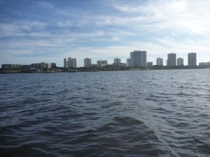
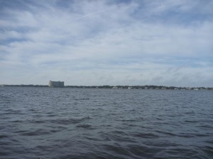
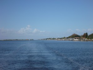
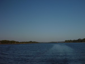
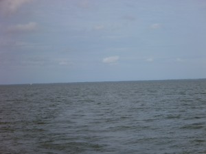
Expanse of waterHere is a visual representation of what we have been experiencing the last few days.
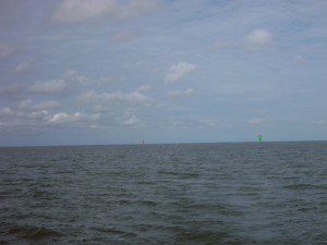
In looking out, it appears we are on a large body of water.


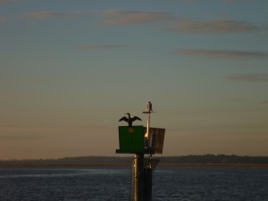
Channel markers

But…..the reality is that we have to stay in the narrow channel or risk running aground.

The channel is marked by the day markers – and so in this vast expanse of water our maneuvering area is between these markers and makes this expanse of water very small for us.

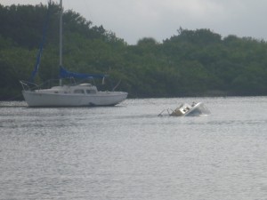
Sunken boatWe have been surprised by how many derelict and sunken boats we have seen along the way in Florida.  It is unfortunate that these boats are not removed and are allowed to become an eyesore.

NASA RR bridge

Our only unexpected hazard today was the NASA railroad bridge which is unattended and reportedly usually open.  As we were approaching, someone hailed us on the radio and warned us that the bridge was not in the full open position.  Oops…. we thought it looked a bit wrong but with this confirmation Bob edged over to the side to be sure our mast would clear the partial opening.

We arrived in Titusville where we were assigned a slip where we had to do a 4 point tie up – going stern in and securing the bow to two different pilings.  We hadn’t done one of these docking since Elizabeth City and were definitely not prepared!  But with the patience of the dockhands we got the boat secured with out harming the boat, the neighbor’s boat, or the dock.  (We were also glad there were no other residents around to watch us!)

Titusville doesn’t have the same number of restaurants as New Smyrna, but we were able to walk to one on the water under the bridge nearby.  As we were finishing up our dinner, friends we first met on Thanksgiving on Lady’s Island, and again on Jekyll Island wandered past.  Looking to be with other boaters, they joined us for a drink and good conversation making for a pleasant end to a pleasant day.

Water to the left of us – water to the right…..

Monday – 14 December

P1020674Water to the left of us water to the right…..Here we are…. stuck in the middle of the ditch.

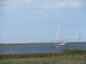
P1020673If you looked out to  either side of us you would have seen what looked like vast expanse of water.  If you look at the charts you would see very shallow water off the channel. So for another day we focused on the magenta line and the narrow channel of the ICW in an attempt to successfully avoid going aground again.  Florida really is teasing us!

P1020676

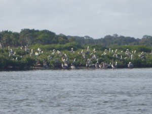
We both agree that pelicans are cool birds.  And here there seemed to be a pelican convention.

We had another pretty uneventful day today with only two nail biting or adrenalin raising moments.  The first was at the George Massonn Bridge where we had to wait for a scheduled opening for a few minutes with a few other boats.  Just as the bridge was about to open, a funky current took over our bow and Bob had little to no control as we spun hard to port.  Giving it more throttle he was able to regain control while we watched the other sailboat waiting with us  do a similar dance.  It seemed to take the bridge a long time to open as we milled around trying to avoid another spin.  When the bridge finally opened, we proceeded through with no further issues.

Our marina for the day is located just after the bridge.  We radioed ahead and Christina busied herself getting the fenders and dock lines ready on the foredeck.

The markers got confusing with a bifurcation marker leading Bob astray.  He ended up doing a U turn in the middle of the channel, trying to get his bearings while checking the charts and the markers with the binoculars.  We finally figured out which way to go and continued on.  Before we were able to catch a breath, it was time to turn into the marina.

We should have taken the hint when the dock master had asked, and  then asked again if we really wanted to go into the slip stern in.  He let us know that the current and wind would be to our stern so we would be plowing into it.

Bob executed the initial entry into the slip well, and Christina handed the dockmaster the spring line.  Then things went funky and the rest of the   maneuver into the slip was not the most graceful.  Christina fended off our next door neighbor and then jumped off the boat onto the dock to continue to push our boat away from the dock we were being pushed onto as Bob continued to maneuver the boat into the slip backwards,  We were thankful for the bow thruster, but, even with that, somehow we got twisted up getting into the slip.

No harm was done, and we eventually got securely tied up.  Christina wonders if she needs to get back to lifting weights so she can more effectively push the boat off the dock against the current in the future.

Finally we were able to catch our breaths and got settled in.  We took a stroll through the old part of of New Smyrna Beach which has experienced a revitalization with some awesome restaurant offerings.  Christina wants to stay another day just to try a few more out!

But no, we head out tomorrow for Titusville, Florida for our last night as a transient before arriving at out initial final destination of this part of the journey.

The magenta line – a blessing and a curse 

Sunday, 13 December

Palm coast to Daytona Beach

We left Palm Coast Marina in the morning with no issues.  We expected a relatively uneventful day after we navigate two minor “hazard” areas as identified by ActiveCaptain.  For the first time there are absolutely NO hazards of shoaling or anything else to cause us concern for the rest of the day.

We knew not to get too complacent, but were  enjoying watching the scenery go by.

In an area that didn’t have any hazards listed and no visible signs of problems, we found ourselves stopped and aground. We did a quick survey  of the charts and electronics to try to determine where the deeper water would be found and Bob was able to back us off the sandbar and into deeper water.

In review of the situation, there had been two green markers and Bob had steered to what he thought was the middle of the channel.  The electronic chart shows the middle of the channel with a magenta line.  In reviewing this chart it showed that the “middle” of the channel was actually close to those greens.

P1020671Throughout this trip we haven’t really focused on the magenta line because in so many of the “hazard” comments along the way the continual theme is don’t follow the magenta line blindly, follow the visual channel.  Many people get into trouble when they navigate purely with the electronic instruments without using the actual markers and visual sightings.  There are known errors with the charts which is why it is important to use all the tools at your disposal….including your eyes.  But with today’s grounding we guess we will be following the magenta line more closely through Florida, where the canal is wide but the channel is narrow.
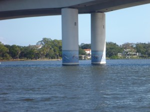
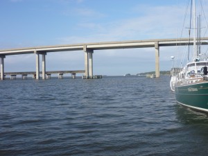
P1020672Approaching Daytona Beach at the end of the day entailed crossing under two draw bridges where we had to request openings, and two unrestricted fixed bridges in short order.  This is the prettiest bridge we have crossed under to date.

We were thankful for our 55 foot mast because it was close to high tide and even though the two fixed bridges have 65 foot clearances, the height markers indicated only 62 or 62.5 feet clearance.  We heard multiple boats on the radio trying to figure out when the water would drop lower so they could clear the bridge with their 63 foot (or higher) masts.  In the meantime they were forced to anchor alongside the channel to wait for the tide to go down.

We were able to make it easily to our marina, dock with no issue and enjoy another quiet evening.

USCG Sector Jacksonville is busy….

Saturday – 12 December

St. Augustine to Palm coast

Yesterday we had heard multiple boats on the radio report grounding between green markers 81 and 83.  Friends on a catamaran (shallow draft) had transited the area the day before and emailed us that they had seen a trimaran (shallow draft) caught up with one of the markers.  So we wanted to be prepared and did our research.

Ft. MantanzasChannel markers are in numerical sequential order and when new markers are added a letter is included.  Between G81 and G83 there are 4 additional markers:  G81A, G81B, G81C and G81D in quick secession really highlighting the channel.  All comments said to respect these markers which we did and had no trouble – yay.  (The next day we would hear a Coast Guard broadcast about an unmanned sailboat at this location — we never did find out what happened there.)

Throughout the day today we heard a lot of different Securite and PanPan messages broadcast by the United States Coast Guard.

  • Capsized sail boat in the ocean
  • Reports of a flare being seen
  • Shipping containers may be floating and causing hazard to navigation
  • Orange live preserver spotted floating in the water
  • Dinghy on a jetty
  • and more

A few days ago a barge headed to Puerto Rico from Jacksonville, FL reportedly lost 25 shipping containers off the coast of Florida .  We have heard many horror stories of boats hitting errant shipping containers in the open ocean with catastrophic consequences.  Some believe these stories are folklore and any containers that do fall into the ocean would sink quickly.   Others say no, they can and do float sometimes.  There were reports of pallets of coffee and other foodstuffs washing up on beaches near Cape Canaveral.  Today the Coast Guard put out a Securite message reporting hazards to navigation…. sightings of shipping containers near Jacksonville.  We never did hear if any were ever really spotted, but were glad we were not out in the ocean to find out.

From the sternOtherwise, it was a lovely quiet day on the inland ICW.


A really lovely day today….

10 December –

P1020656Today was an absolutely beautiful and relaxing day on the water.

P1020657P1020658The Waterway was so very wide, deep and straight for most of this section there were no real navigation challenges, no shoaling hazards, and really nothing to worry about except staying alert for stray debris in the water and making minor adjustments to the auto pilot to stay in the center of the channel without drifting.   P1020659

For the first hour or two we passed by beautiful homes on one side and marshes on the other.

P1020660P1020661Then it seemed like we had left all civilization behind (except for the channel markers) and were only surrounded by marsh.  We saw very few boats on the water, and those were only small fishing boats so we were really able to enjoy the quiet and solitude.  P1020663

P1020664 - noThe only negative was this was the first day in weeks that we didn’t have a dolphin sighting – what’s up with that?

We had favorable current and our speed topped over 9 mph today as we glided along.  When it was time to make the 90 degree turn into the short channel for the marina we knew the current would again be pushing us sideways until we passed the channel entrance when all current should dissipate.

Again, Bob did a great job crabbing the boat through the markers with the bow pointed 45 degrees to starboard.  What Bob wasn’t ready for was how quickly the current drops, and after passing a small spit of land on the right the current died and with the engine at full force and no current pushing us sideways we found ourselves heading straight toward the land mass to the right!

Bob made an exclamation and Christina’s heart dropped into her stomach in that moment.  But thankfully the boat responded quickly enough to Bob’s steerage and he was able to correct the course to keep us in the channel toward the Camachee Cove Marina in St. Augustine where we will spend two nights.

This is the last planned two night stay before we reach Cocoa, Florida where we will be spending a month or more.

We’ll spend tomorrow exploring the town and enjoying Florida sunshine and warmth.


Crazy Currents

09 December

We were happy to have a dockhand assist us in getting off the dock today as we had to do a 180 degree turn in the fairway.  The dockhand kept hold of our stern dock line which helped prevent us from drifting into the boat ahead, the boat behind or the boat across from us.

But after that successful maneuver we had a pleasant morning making our way down the channel.

As we approached a draw bridge we saw our friends on s/v Belle Bateaux who had left Fernandina Beach 30 minutes before us docked at a city park off the ICW.  We waited until after successfully arranging a bridge opening and traversing across a strong sweeping side current to cross the St. John River and reenter the ICW before hailing them to be sure all is well.

They explained how they had decided to do a short day today and in the next breath warned us we were approaching a bridge where we could expect a 5 knot current going against us.   We jokingly said “guess we’ll be going slow through that bridge”.  We learned they were indeed right.

We reviewed the notes in the Cruising Guide and only then really noticed the comments on “strong” and “unusually strong” currents at the next two bridges.  We started doing some calculations and realized we would be hitting these bridges at about low tide which calculates to the strongest current against us most likely….oops we didn’t plan that one too well.

As we approached the first bridge the swirling currents made it pretty difficult for Bob to control the boat as he lined up on it.  The current was bouncing us around quite a bit.  But once under the bridge the current dissipated and there was no real problem.  Whew! that wasn’t so bad.

The next bridge was a different story.  In Bob’s words there was “off the charts crazy swirling current” and he really struggled to keep the boat straight as we approached.  The current pushed us around even more forcefully and we would be straight one second and almost horizontal the next going from right to left.  We really wondered if we were going to be able to pass under this bridge without hitting the sides if we were pushed to one side or the other at the wrong time.

Bob did a great job getting us straight, and thankfully again the swirling subsided as we proceeded under the bridge.  But this time the current was even stronger against us.  We went from going over  6 MPH to less than 2 as we slowly plowed through the current.  (Something to realize is that unlike a car, there are times when going slower you have less control of a boat, since you sometimes need momentum to keep you going in the desired direction.)  We both held our breaths as Bob struggled, and were very thankful when we cleared the other side of the bridge.

Belle Bateau probably called this one right by waiting for a rising  tide or slack water tomorrow to navigate these two bridges.  Lesson learned.


Welcome to Florida

08 December – Goodbye Georgia – Hello Florida

We headed out early this morning around 0730, leaving Jekyll Island behind and enjoyed a lovely and pretty uneventful day.  The potential trouble spots of shoaling caused us no concerns.

P1020655Throughout our travels in the south we keep seeing these goofy birds.  We haven’t researched to learn what they are yet.  They sit on pilings with their wings outstretched as if to dry themselves.  And some hold this pose on only one foot, as if doing a yoga pose.  They always make us smile.

We said farewell to Georgia and its winding rivers as we crossed the St. Mary River and arrived in Fernandina Beach, Florida.

We were tied to the dock by early afternoon and spent  the afternoon exploring this historic waterfront town.  We are only spending one night here, but think we will be back again to enjoy it more fully.

On to Jacksonville, Florida tomorrow.

A lovely day and a magical evening

07 December – Jekyll Island, GA

We had a most pleasant day on Jekyll Island.  We enjoyed a lovely bicycle ride exploring (it was great to get some exercise).  We visited the sea turtle sanctuary followed by sharing a nibble and drink at a pub.

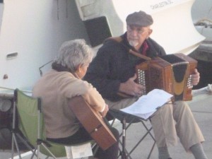
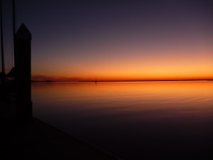
P1020648In the evening a dock mate pulled out his accordion and began playing, joined by another dock mate with her guitar, during an amazing sunset.
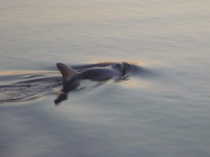
DolphinA dolphin appeared to be quite taken with the music because it kept swimming around the boat….it was kind of magical.
After sunset
(With permission from the musicians, I have uploaded some video with the music.  Unfortunately the dolphin became shy once the video was recording and did not resurface to be filmed….)


Happy to have the chart plotter

Thursday – 3 December

You know how it can be – for every relaxing day you can expect a non-relaxing one when transiting on a sailboat.  Today we transited a short but hairy 10 miles/16 km with big wind (25 – 30 knots) and choppy water through a very narrow difficult channel with white water rapids on one side and within 25 feet of the grass (land) on the other.   Through all this we also had to line up on a set of range markers to ensure we stayed in the deeper water of the channel while not hitting the channel markers.  

(An explanation of range markers by the US Coast Guard:  navigational aids, which are usually shore-mounted, come in pairs to help the vessel operator maintain a straight and safe course within a navigable channel. Each member of the pair is separated from the next in distance and elevation, with the one in front shorter than the one behind it. When the two appear to be vertically stacked, the vessel is on the range line.)

So, while staying between the channel markers, keeping reds to starboard, greens to port, being bounced around in the wind and choppy water, figuring out which reds and greens were for us to follow and which were marking other channels, we also had to focus on the boards ahead, steering so the two boards were vertically stacked in order to stay in the channel.

Through out the transit Bob also tracked our progress with the chart platter which also shows the channel and he was especially thankful for that today.  The channel markers were confusing and the channel was difficult to make out visually so the electronics really helped.

Immediately after Jekyll Creek, where we thankfully had no problem with depth, with the strong current still pushing us along, we passed under a bridge and immediately into the marina.

Dreamtime2While still under the bridge and as we approached the dock Bob put the boat in reverse at least 150 yards/137 meters before the dock and “hard” reverse 30 yards / 3 meters before the dock, wondering if the boat would actually stop in time.

P1020632He skidded in with an ice hockey-like stop and executed a perfect docking. It was amazingly smooth and Christina and the dockhands were oblivious to the level of challenge Bob was experiencing.  Dreamtime at dock

The winds are expected to be even stronger tomorrow so we already planned to stay here for 2 nights.  Sunday is expected to be like today, so we knew it would be doable.  But…..after talking with the dock master we learned St. Andrew’s Sound, which we will be crossing when we leave, is even more exposed and choppy than St. Simon’s (taking you to the edge of the ocean). Hmmmm…. maybe we’ll stay another day.

Monday looks to be a good day for weather but in reviewing the tides and sunrise time, a departure on Monday would have to be before sunrise and would require transiting the more tricky part(s) with the sun in our eyes….soooooo…. we decided to make a 2 night stop into a 4 night stop.  We’ll leave Tuesday.

ChristinaBobDudleyWe ended up being docked just in front of s/v Belle Bateaux a 44′ Gozzard. (They were quite thankful Bob was able to control Dreamtime as we passed by their boat during the docking maneuvers once they heard the full story of the hockey stop.)  We caught up with them for a sundowner and a spontaneous potluck dinner the first two nights on Jekyll Island that included new friends, good food, hours of laughter and comparing notes on our respective boats and journeys.  (Thanks to them for photos of our arrival.)